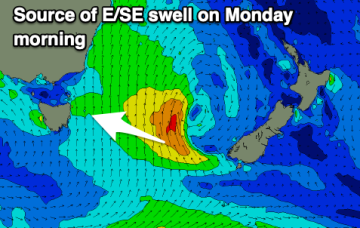
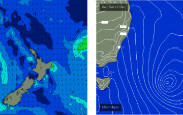
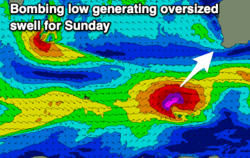
Large swells inbound with winds out of the south-eastern quadrant
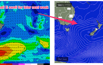
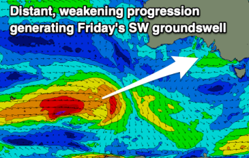
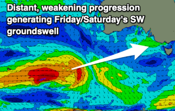
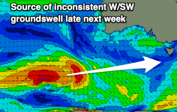
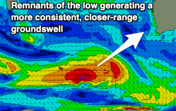
Plenty of swell this period as winds become a little less favourable though still good for a variety of breaks.
The combination of a Tasman low and strong high moving through the Bight has supplied a stack of S swell to the f/cast region since late last week, with an intensification and N’ward movement of the low upping the size and local winds through today on the MNC, and across the rest of the region through tomorrow. Pressure gradients will now slowly ease as the low starts to dissipate and the strong high weakens as it moves South of Tasmania through tomorrow.
Pressure gradients will now slowly ease as the low starts to dissipate and the strong high weakens as it moves South of Tasmania through tomorrow. As this swell generating pattern breaks down we’ll be left with a weak, troughy pattern coming into the Xmas weekend with no major swell sources on hand, so you’ll need to get your grovel boards ready for Santa.
The coming days will be small to tiny ahead of a good new groundswell Friday, but with an onshore breeze.
There's a weak mix of swells with east winds due over the coming days ahead of some new groundswell late week. Winds will deteriorate as the swell peaks.
Good options in protected spots as the swell continues all weekend and early next week while clocking more east in direction.
A good swell will be spoilt by onshore winds on the weekend. Early next week will be cleaner but small.
There's no evidence to suggests any deviation away from the current regional trend for the east swell.
A reintensification of the Tasman Low on Saturday and Sunday - further east, near New Zealand - will generate a renewal of strong S/SE thru SE swell for Monday.
The coming period looks fun with plenty of swell (small to tiny Mandurah/Perth) and with morning offshore winds.