Small, fun surf continues with a rare SE groundswell for the weekend
Wednesday, 25 January 2023

Small, fun surf continues with a rare SE groundswell for the weekend
Wednesday, 25 January 2023
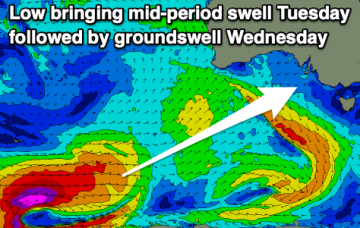
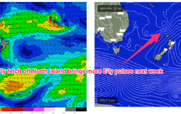
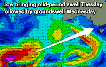
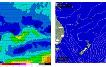
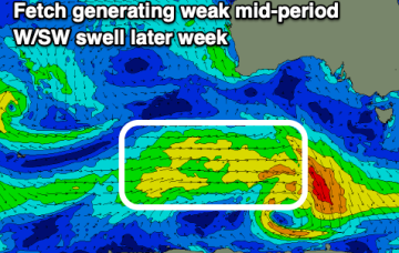
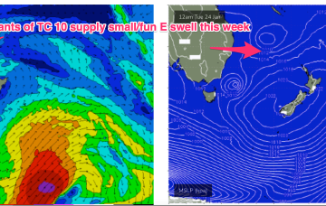
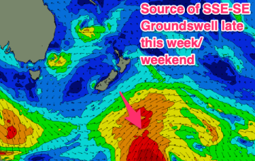
The synoptic pattern over and surrounding Australia still has a strong La Niña signature with troughy low pressure areas in the Tasman Sea and an active monsoon trough across Northern Australia. High pressure on the other side of New Zealand is cradling areas of low pressure and maintaining a small, fun E swell signal.