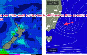
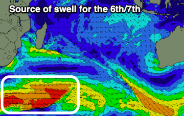
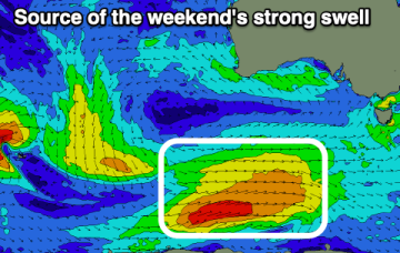
There are no standout days this period
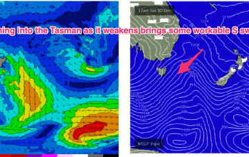
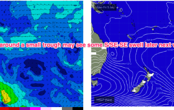
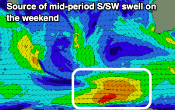
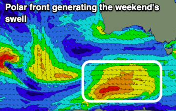
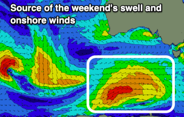
Onshore winds will continue to create poor surf, with windows of lighter winds not being enough to fully clean up the swell.
Models are divergent as to the fate of the trough with GFS suggesting a deepening of the system as it moves northwards, potentially forming a closed surface low and generating plenty of S/SE-SE swell Fri and into next weekend.
The coming period will remain very average thanks to persistent onshore winds, spoiling fun swells.
Fun swell into Sunday/Monday, slow the rest of next week with better activity to follow. Lots of swell for the Maldives but with tricky winds.
A complex inland trough/low is emerging from the Gippsland coast into the Tasman Sea with a fetch of SE-E/SE winds aimed at Tasmania and offering some plenty of E-E/NE swell, easing tomorrow.
Plenty of quality surf days between onshore blows this period and strong swells.
Elsewhere, it’s a bland pattern with a dormant Coral Sea. Cold fronts later this week and over the weekend will supply some minor S swell favouring NENSW S facing beaches.
There's some fun swell for the end of the week in the South West with windy, but favourable winds.
No great change to the summer pattern with a massive heat dome over Central, Western and Northern Australia spawning trough lines which are creating unstable, stormy weather across large swathes of the East Coast. A complex inland trough/low is emerging from the Gippsland coast into the Tasman Sea with a fetch of SE-E/SE winds aimed at Tasmania and offering some small sideband energy up into Southern/Central NSW.
There's plenty of swell due over the coming days and winds look to be lighter at periods. It won't be perfect though surfable.