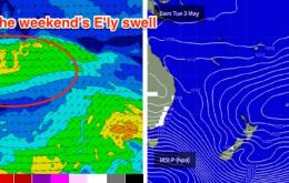
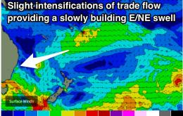
Small trade-swell peaking over the weekend
Wednesday, 4 May 2016

Small trade-swell peaking over the weekend
Wednesday, 4 May 2016
Modest trade-swell peaking this weekend, possible strong S'ly groundswell late next week.
Modest trade-swell peaking this weekend, possible strong S'ly groundswell late next week.
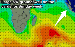
Mix of SW and S'ly swells most of the week with favourable winds, fading into early next week. Some fun SW swell developing later next week ahead of hopefully a larger SW swell Sunday week.
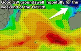
Fun easing S/SW swell tomorrow and Thursday morning with a new large S/SW swell building Thursday afternoon, peaking Friday under variable winds.
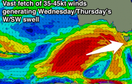
Building clean W/SW swell tomorrow, peaking Wednesday with improving offshores, clean and easing Thursday, further Friday.
Not a great week for surfing. Friday is looking like the best of a small bunch.
I’d book in some flexi time if you can for Friday, as the second half of the weekend outlook is a little concerning.
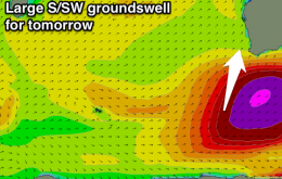
Large S/SW groundswell filling in tomorrow with workable winds on both coasts, easing Wednesday as onshores kick in down south. S/SE winds and a reinforcing swell for Thursday then onshore through Friday and the weekend.
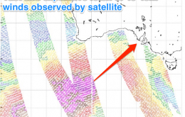
Large powerful building SW groundswell for tomorrow, peaking Wednesday with offshore NW winds. Easing very slowly into the end of the week with offshores continuing. Cleanest on the Mid Friday but fun Wednesday and Thursday.
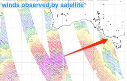
Slow start to tomorrow ahead of a clean building W/SW swell on the Surf Coast ahead of a very large and powerful groundswell Wednesday with offshore winds. Slow easing trend into the end of the week as winds remain favourable.
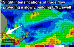
A slow building trend from the east for the rest of the week.