Slow increase in trade-swell throughout the week

Sydney, Hunter and Illawarra Surf Forecast by Guy Dixon (issued Monday 2nd May)
Best Days: Each morning, more size but dicey winds over the weekend.
Recap:
Conditions remained generally workable across the weekend, with northwesterly breezes only tending northerly at times during the middle of the day.
An easterly swell eased slowly throughout the weekend, with Saturday offering 2-3ft options, more so in the 2ft range on Sunday.
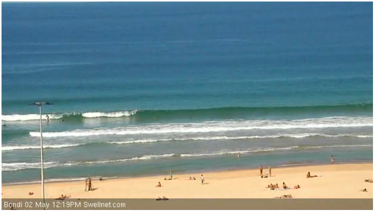
Easterly energy has been underperforming today, providing just 1-1.5ft across most coasts. A small southerly swell is beginning to provide 2ft sets across south facing beaches this afternoon.
Fortunately, light offshore breezes kept conditions clean this morning, only giving way to a seabreeze from late morning.
This week (Tuesday 3rd - Friday 6th):
A strong front and cut-off low which exited Bass Strait over the weekend generated a small southerly swell which is starting to show across exposed south facing beaches today, with sets in the 2ft range. Judging by the wind observations over the weekend, it shouldn't build much more than 2ft.
The second of two pulses should move through overnight, slowing an easing trend from the 2ft range on Tuesday.
The strongest nodes of the long wave trough will otherwise continue to remain to the east and west of the NSW swell window, steering frontal progressions in poor alignment.
Any southerly energy looks to be negligible in the coming week with the exception of a small southerly pulse to around 2ft+ on Thursdsay morning (2-3ft Hunter). Otherwise, we must rely on the our eastern swell window for energy.
Obviously the easterly energy that was forecast for today (on Friday called 2-3ft) is underperforming, with open beaches only seeing just over 1ft today. With that, continued energy off this trade fetch will be scaled accordingly.
Tuesday and Wednesday are likely to be similar to today, with only hints of energy breaking at around 1ft or so. Later in the week however, we should see easterly trade energy slowly build as a result of an intensification in the trade flow.
Conditions are likely to be clean virtually all day on Tuesday under a persistent northwesterly airflow. Similarly, Wednesday is in line for clean conditions during the morning under a west/northwesterly airflow, giving way to a seabreeze from late morning/early afternoon.
A deepening trough over the northern Tasman/South Pacific looks interact with a strong ridge over NZ causing the pressure gradient to tighten and the main swell generating winds to tend more easterly as opposed to the east/southeasterly trade flow of the past few days.
Thursday should see a slight increase in size, with sets in the 1-2ft range across the open beaches, building to around 2ft by Friday.
Light west/northwesterly breezes look to gradually swing thru northerly to the northeast by late morning on Thursday and Friday, so make most of the morning sessions for the cleanest waves.
This weekend (Saturday 7th - Sunday 8th):
Despite weakening and becoming smaller in area, this fetch looks to drift closer to the NSW coastline while adopting a more northeasterly alignment.
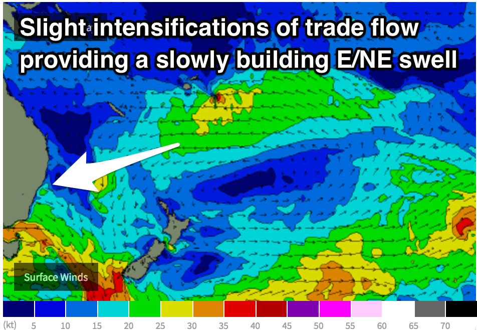 Trade energy should continue to build as a result, increasing to around 3ft across the weekend, predominately due to the modest captured movement of the main fetches.
Light/variable-northerly breezes are expected to give way to a northeasterly seabreeze fairly easily on Saturday, limiting the better options to the morning once again. Sunday looks to see a gusty northerly breeze swing northeasterly, leaving few chances for a clean wave.
The only decent option for a wave on Sunday will be found at the north ends of open beaches during the early morning, otherwise quality looks dicey.
Next week (Monday 9th onward):
Further ahead, early indications show a strong front to move over Tasmania on Sunday, with a potential cut-off low developing over the Tasman Sea into Monday. In this scenario, a short range southerly swell may build as a result of local south/southwesterly fetches, followed by more substantial groundswell generated by broader, more intense, distant fetches over the Southern Ocean.
More detail on Wednesday.
Comments
18th of May on the WAMS is showing some solid S swell coming up the NSW coast with W winds... Any chance it could be a large swell? Shark Island Challenge could potentially run if its big enough.
Shark Island doesn't like south swells.
Regardless, the 18th is two weeks away, in somewhat fantasy land for computer models, so take anything beyond a week with a grain of salt (though, the broader synoptic pattern of successive strong frontal systems is quite likely given what's happening elsewhere).
However, the swell you've indicated on the WAMs around the 18th is (if it were to eventuate) actually a strong refracted south swell from a W/SW fetch behind a cold front, and would almost certainly not benefit Shark Island.
What you want to see is a Tasman Low (not an ECL, as its swells are sometimes too big, and the local winds too dicey) or another system in the central-eastern or south-eastern Tasman Sea, generating a swell out of the SE quadrant (anywhere from the S/SE thru' E/SE). Best bet would be a big stationary low parked off the west coast of New Zealand's South Island with a broad fetch of 40-50kt E/SE winds extending westwards into the Tasman Sea.
But.. perfect systems rarely eventuate so it's more likely we'll get a hybrid system that'll have some of the features we need - but not all.