As the trough block exits, the south swell window lights up

Sydney Hunter Illawarra Surf Forecast by Ben Matson (issued Monday 5th July)
Forecast Summary (tl;dr)
- Strong though easing E/NE swell from Tuesday thru' Friday
- Small S'ly swell Tues, bigger S'ly swell building Wed, easing Thurs
- Another S/SE groundswell Fri/Sat though no major size
- Interesting low off the coast Fri/Sat, confidence low but there is pontential for a short range S'ly swell
Recap
The trough block came through with the goods. 3-5ft surf on Saturday and early Suinday, boosting to 5-6ft late Sunday and holding today, clean with offshore winds. Some fantastic sessions reported right across the Southern NSW coast. Hope you got some!
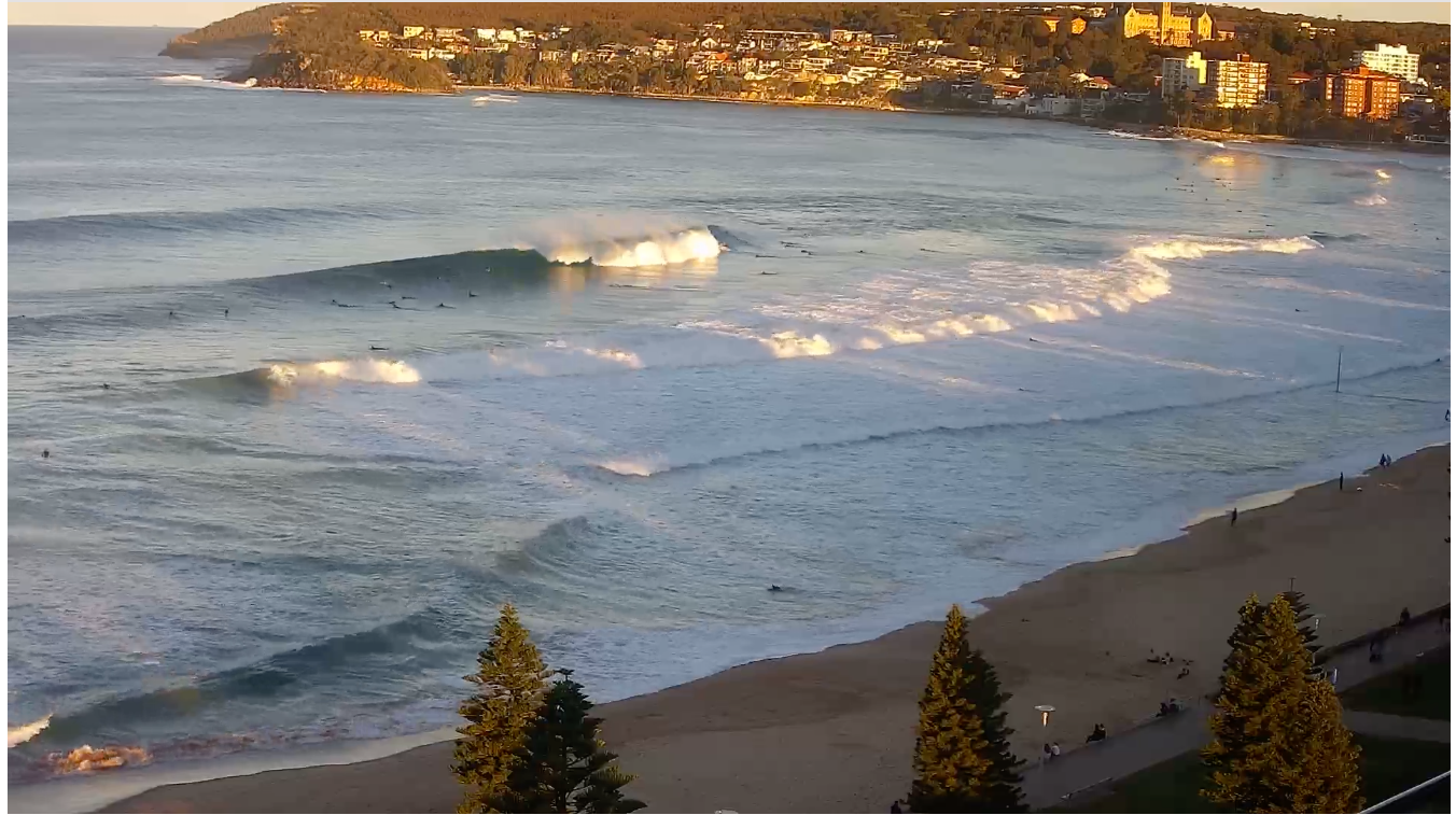
Manly this afternoon
This week (July 6 - 9)
The trough block is slowly pushing eastwards under the influence of a regional frontal progression. We've still got 25 - 30kts of favourable aligned E/NE winds in our swell window, but the eastwards storm track is detrimental to swell prospects.
However, the fact that the trough block's been in place since last last week somewhat compensates, as the current (easing, retreating) fetch is working on an already active sea state. And, the supporting ridge to the north-east stretches out into the South Pacific, and should remain active for another 24-36 hours (albeit much weaker in strength, and less favourably aligned).
As such we'll see surf size ease over the coming days but it should still be pretty punchy on Tuesday. Size wise, I'm not going to change Friday's prediction, which is for 3-5ft surf on Tuesday easing to 3-4ft on Wednesday, then 2-3ft on Thursday and 2ft on Friday. Expect the consistency to dry up a little over this time frame.
As for conditions, they look pretty good all week. The broadscale frontal system crossing through the Tasman has swung the synoptic wind to the SW where it'll remain until Thursday, though it should be generally light in strength. We may see southerly tendencies throughout the days though early westerlies are also possible in a few spots.
Late Thursday may see a brief N'ly as a weak trough crosses the coast, ahead of a fresh W'ly change on Friday as a small low forms along the trough line. However it doesn't look like much of a swell producer until Saturday, and even then it's not looking to be well aligned for our region.
Also! We have some south swell on the way this week.
Gusty SW winds exiting eastern Bass Strait today will kick up a small south swell for Tuesday (3ft south facing beaches) ahead of a stronger south swell building Wednesday, sourced fron a strong parent low/front combo below Tasmania today. Wednesday morning looks like to be undersized, but surf size likely to push 3-5ft at south facing beaches late afternoon, and up to 4-6ft across south swell magnets like the Hunter. Of course, expect smaller surf at beaches not directly exposed to the south.
A strong polar much further south (on Tuesday) should then generate a smaller S/SE swell for Friday and Saturday in the 3ft+ range at south swell magnets.
This weekend (July 10-11)
As mentioned above, we've got some underlying long range S/SE groundswell for Saturday in the 3ft+ range. It'll be inconsistent but should hit the south swell magnets reasonably well.
But, making the surf outlook a little difficult is a small Tasman Low expected to form off the coast on Friday, along the trough line. Current model guidance suggests the strongest flanks will be its northern (i.e. W'ly winds) and south-eastern (i.e. E/NE winds), all of which will be aimed generally away from Southern NSW. So, right now there's not a lot of confidence for a major swell event. Though minor swells from the north (Friday), south (Saturday) and south-east (Sunday) are all quite possible.
That being said, small shifts in the model guidance is posisble over the comoing days, and it's quite likely that we'll see a brief but punchy south swell building Saturday, easing Sunday - but I'm not confident to put a size range on it right now. I'll have more details on Wednesday.
Next week (July 12 onwards)
Long range guidance is suggesting a broad zonal flow across the mid-latitudes next week, which suggests a stream of winteresque fronts throughout SE Australia, but not linked to parent polar lows - which could result in only short, brief southerly fetches within our south swell window.
This doesn't necessarly suggest a poor surf outlook, but the flukey nature of these kinds of weather patterns (relative to our swell window) means that the extended forecast outlook has only low confidence right now.
So, make the most of what you see right now!
See you Wednesday.
Comments
Is the trough block being replaced with a trough lolly?
What a run of awesome waves .. some of the most memorable sessions.. local bank turned on very impressive display of non stop waves..