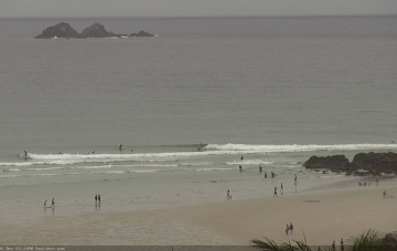
Poor surf and conditions, improving late next week
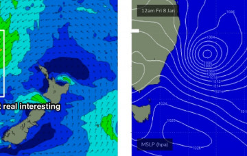
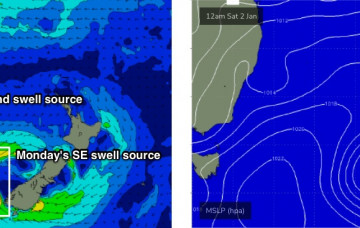
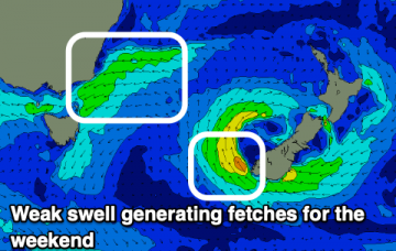
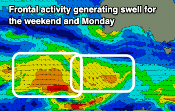
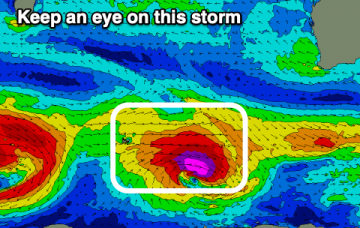
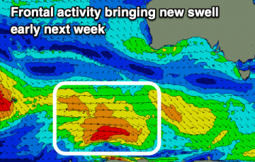
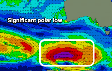
Nothing to recommend over the coming days but we've got an upgrade in the groundswell due later next week and improving winds.
A fun, peaky day for the beaches tomorrow, deteriorating from Sunday through early-mid next week ahead of a large swell.
We’ve got building E’ly swells for SE Qld and Far Northern NSW, originating primarily from a broad, complex series of surface troughs across the lower Coral Sea. More in the Forecaster Notes.
Coastal troughiness will persist for the next few days, maintaining generally onshore winds across the region. More in the Forecaster Notes.
The main synoptic features right now are two surface troughs, one off the Central Qld coast and the other off the Mid North Coast. More in the Forecaster Notes.
The main driver for today’s onshore breeze is the squeeze between a trough off the Mid North Coast, and a high pressure system in the lower Tasman Sea. More in the Forecaster Notes.
Nothing to surf over the coming days before we see a bit more size to a localised windswell through the weekend and next week.
The South Arm will remain active over the coming period but there are no standout days and winds will be dicey and tricky at times.
A run of favourable morning winds, if not a bit blowy at stages with mixed swells, mostly below what's being seen today. Potential for next week.
There's nothing too exciting over the coming forecast period with persistent onshore winds across the South Coast and no decent west swells for the Mid.