A couple of windows from Sunday
Friday, 28 January 2022
A couple of windows from Sunday
Friday, 28 January 2022
There's nothing too special on the cards but there are a couple of windows of fun surf this period.
There's nothing too special on the cards but there are a couple of windows of fun surf this period.
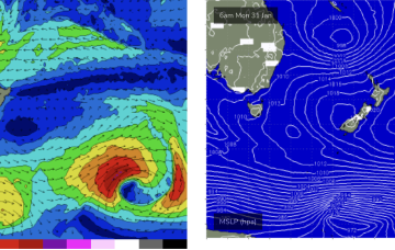
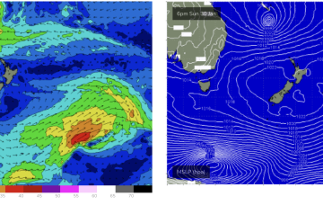
The charts will show a low pressure system tracking in from the South Pacific with a very healthy fetch between the tropical low and a supporting high straddling New Zealand.
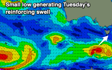
A better swell is due later today but conditions will be best in protected spots, similar when it eases on the weekend.
The coming outlook is tricky regarding finding a decent wave with size. Keep your expectations low.
Winds will slow in their improvement through early next week with the cleanest conditions found now when the swell is a bit smaller but this will favour the exposed beaches.
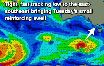
The system broadens and deepens through Tues with extreme winds in excess of storm force, but gets shunted NE before the dateline. This track limits surf potential.
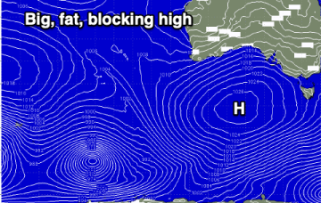
First from the western flank of the high as the tightened pressure gradient sees N’ly winds freshening off the Gippsland coast and aimed well at NE Tas.
That spells a bit of surf ahead. Firstly, from the high pressure ridge as it strengthens and generates a broad windfield of 20knot+ SE winds through the Coral Sea, adjacent to the CQ coastline.
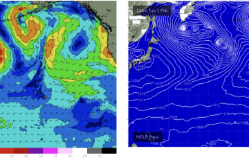
First, from the west as a trough/low tied to the Southern and Indian Oceans moves through WA and SA and then from the East as a tropical low drifts into the slot from behind New Caledonia this weekend. That spells a lot of surf ahead.
First, from the west as a trough/low tied to the Southern and Indian Oceans moves through WA and SA and then from the East as a tropical low drifts into the slot from behind New Caledonia this weekend. That spells a lot of surf ahead.