Good run of conditions with larger surf for the weekend
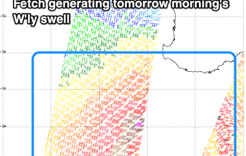
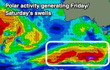
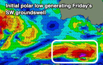
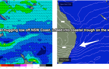
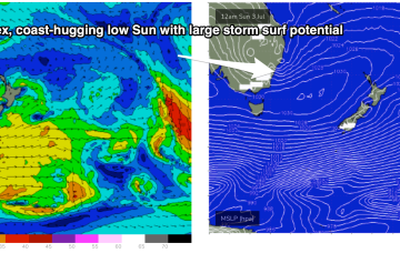
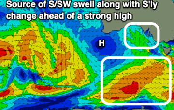
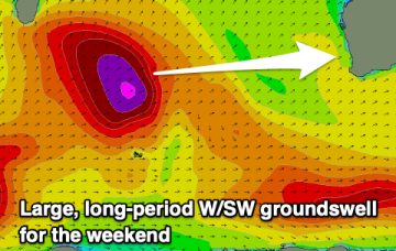
A strong, long-period groundswell is on the way and conditions look to be favourable for selected breaks.
We've got tricky winds over the coming period owing to variable, troughy weather. Winds will be mostly from the eastern quadrant from tomorrow.
Troughy weather and associated dicey winds will most likely spoil a run of moderate sized south-southwest swell energy.
Further ahead and we’ll be tracking a potential south-wards moving coast-hugging low which is expected to form off the NSW or QLD coast later this weekend.
Tomorrow looks smallest ahead of some new swell Wednesday, bigger later week.
Over the weekend another monster high moves well south of the Bight and a series of troughs in the Coral Sea are likely to form either one or multiple surface lows in the basin.
A potentially explosive pattern was mentioned last Mon, for the period leading into the first weekend of July and models are now firming on a strong coast hugging low moving south from the Coral Sea during this time frame. That portends plenty of wind, swell and potentially severe weather.
Fun swells this week with favourable and improving winds, larger on the weekend with an inconsistent, strong W/SW groundswell.
A monster high moving well south of the Bight is expected to rapidly set up a strong ridge along the NSW Coast. Cradled by this ridge will be a very complex series of low pressure troughs, including an interior trough and a broad trough in the Coral Sea, with a potential surface low forming off the QLD or NSW Coast.
Pulses of W/SW swell with clean conditions for the South Coast initially, best on the Mid Coast from Thursday.