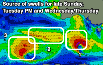
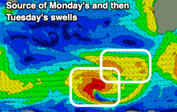
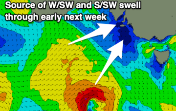
Small Summer surf this Weekend with a S swell on the radar later next week
Friday, 13 January 2023

Small Summer surf this Weekend with a S swell on the radar later next week
Friday, 13 January 2023
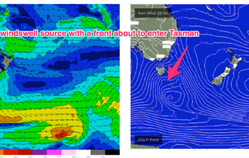
We’ve got a weak, blocking pattern with high pressure (1025 hPa) right smack bang in the middle of the Tasman directing an onshore flow along the Eastern Seaboard. NE across Temperate NSW and SE-E in the sub-tropics. Warm SST (sea surface temperatures) are helping morning land breeze development so conditions should be relatively clean through the early sessions.