Pumping February surf
Friday, 3 February 2023
Pumping February surf
Friday, 3 February 2023
Excellent conditions for protected spots with large swells and lots of options across the state.
Excellent conditions for protected spots with large swells and lots of options across the state.
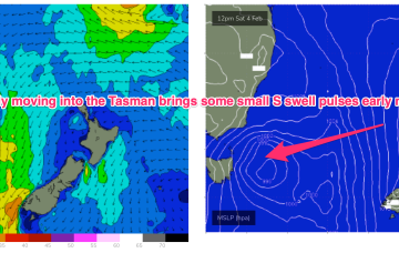
No change to the outlook this week with N’ly flow down the Coral Sea and tiny/flat surf expected.
Fun swells with plenty of windows to get a clean wave in.
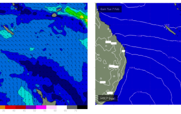
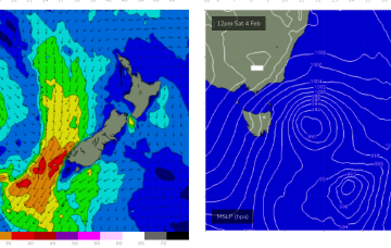
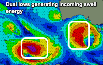
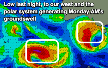
The unstable pattern continues with a small trough of low pressure lingering off the Central NSW Coast, linked to tropical cloud bands and moisture streaming in from the Northern Monsoon. A weak front is crossing Tas with a trough forming t the NE of the state. A large, winter-calibre mid-latitude low approaches from the W and becomes slow moving as it passes the state Fri/Sat.
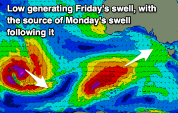
Get stuck into today's swell before it eases, replaced by a couple of more southerly groundswells.
Cold weather with strong onshore winds and an oversized swell developing on the South Coast later week. Winds will slowly ease all weekend as the swell eases.
The unstable pattern continues with a small trough of low pressure lingering off the Central NSW Coast, linked to tropical cloud bands and moisture streaming in from the Northern Monsoon. This unstable, humid pattern lasts through the week before a winter-calibre mid-latitude low blasts a clearing W’ly flow across temperate NSW, with a S’ly change for the sub-tropics. Small, funky E swells maintain surfable conditions through the f/cast period.
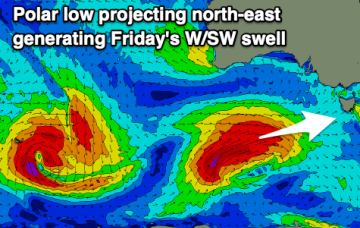
Increasing swell energy with windy conditions and cooler weather for the coming period.
The unstable pattern continues with a small trough of low pressure lingering off the Central NSW Coast, linked to tropical cloud bands and moisture streaming in from the Northern Monsoon. This unstable, humid pattern lasts through the week before a winter-calibre mid-latitude low blasts a clearing W’ly flow across most of the region. Workable pulses of funky E swells maintain surfable conditions until the pattern change beginning Friday, extending into the weekend.
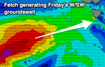
A ton of westerly swell followed by a south-west number on Sunday.