Weekend o' south swell, aim for the mornings

Sydney, Hunter and Illawarra Surf Forecast by Ben Matson (issued Friday 6th December)
Best Days: Plenty of S'ly swell Sat/Sun/Mon, but aim for a morning paddle for the best conditions (Sat PM should also be OK).
Recap: Thursday saw the expected size increase push through with 3ft+ sets at south facing beaches, and bigger 4-5ft waves across the Hunter, but smaller surf elsewhere. Light morning winds preceded afternoon nor’easters, before an evening W’ly change that swung S’ly in the early hours of this morning. Today has seen surf size steady around 3ft, which is a little under forecast expectations (though, it was a low-confidence outlook, and wave heights still came in well above model expectations). The Hunter has seen bigger surf again around the 4ft mark. Winds have generally been light and variable all day.
This weekend (Dec 7 - 8)
We’ve still got a stack of strong southerly swell on the short term outlook.
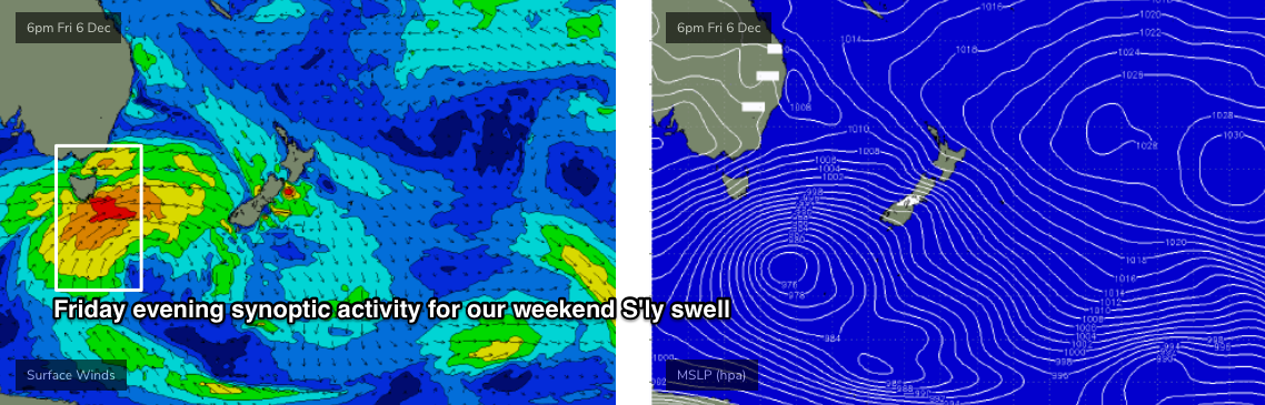
The parent low to all of the fronts responsible for this week’s seemingly endless southerly swells is now moving out from beneath the Tasmanian swell shadow (see chart below), and will generate building S’y swells through Saturday, peaking Sunday before easing slightly but still maintaining plenty of surf into the start of next week.
Saturday morning will probably see a brief period of undersized conditions, before wave heights trend upwards through the day, and by late afternoon or early Sunday most south facing beaches should see inconsistent 3-5ft sets. Across reliable south swell magnets like the Hunter, surf size could reach 5-6ft for a period of time.
Of course, anywhere not directly open to the south will be much smaller, and you’ll need to work around the local winds for the best waves.
Saturday morning should see mainly light variable winds though an overnight S/SE change (tonight) may linger about some coasts for an hour or two at dawn (mainly the Hunter). However most regions should see variable winds for much of the day, with only light to moderate afternoon sea breezes.
Sunday is a little trickier. A weak high in the Tasman Sea will freshen E/NE winds through the day, though we should see a period in the early morning with light variable winds. Expect bumpy conditions from late morning onwards though.
Next week (Dec 9 onwards)
The low responsible for the weekend’s south swell will remain active into Sunday morning, though it will be aimed less favourably within our swell window by this time so surf size will be slowly easing from Monday. Early morning should still manage 3-4ft sets at south facing beaches (bigger across the Hunter, but smaller elsewhere) ahead of a slow downwards trend into the afternoon.
Freshening NE winds will day will be lightest early morning, so aim to get wet before mid-morning for the best conditions.
The developing NE airstream won’t be overly strong, but some NE swell magnets may pick up slow 2ft+ sets for Tuesday morning. An approaching trough will eventually disrupt the local airstream though it’s currently unclear how this will eventuate. Model guidance suggests morning northerlies and afternoon easterlies, though I don’t have a lot of confidence in this right now. Though with only low swells prospects (small NE windswell, minor leftover S’ly swell) it’s not worth getting too worried about.
The rest of the week looks a little nondescript. A brief southerly change associated with Tuesday’s approaching trough probably won’t generate any notable S’ly windswell, and a series of fronts passing below Tasmania early the week look too poorly aligned to generate any strong surf for our region (though we should see some small waves from this source).
A more significant S’ly change is pegged for Friday and its parent low to the south looks like it’ll generate some decent S’ly swell for the following weekend - but more on that in Monday’s update.