Large and windy Saturday, rapidly improving Sunday

Sydney, Hunter and Illawarra Surf Forecast by Ben Matson (issued Friday 17th July)
Best Days: Sat: get into a sheltered corner. Sun: strong S'ly groundswell with light winds (south of the Northern Beaches) and improving conditions. Likely to be still S'ly in the Hunter. Mon/Tues: easing S'ly groundswell with light winds tending NW. Wed: small long period S'ly groundswell with light winds tending NE. Thurs, maybe Fri: building NE swell
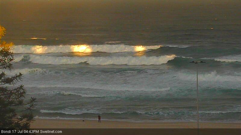
Recap: Thursday saw a reinforcing pulse of S’ly swell providing good 3ft sets to south facing beaches, with bigger waves in the Hunter, along with clean conditions for most of the day (Sydney saw a three-hour S’ly tending SE flow associated with a mesoscale low, but it cleared quickly and W/NW winds returned from lunchtime). Thursday’s swell eased slightly this morning and was clean early under a freshening W’ly breeze, but gale force S/SW tending S’ly winds have enveloped the coast as a low pressure system intensifies off the coast. Interestingly, winds have recently swung W/SW across many locations in the last hour or so (see image below of Bondi in lovely late arvo golden light!) but they should return to the south shortly.
This weekend (July 18 - 19)
No changes to the weekend forecast. We’ve got a complex mix of south swells both arriving and departing, but in any case Saturday’s conditions will be heavily affected by gusty trailing southerly winds in the wake of the low, as it tracks eastward.
Saturday's size estimation has been increased a little, thanks to the models strengthening a front pushing up through the southern Tasman Sea this afternoon. South facing beaches should hold somewhere in the 6ft+ range throughout the day, with bigger surf likely near 6-8ft+ across the Hunter. Much smaller surf is expected at protected locations but they’ll be your only option under a gusty S/SW tending S’ly breeze. We may see a few pockets of SW winds early morning but it’s unlikely to offer anything worthwhile at exposed locations.
On Sunday, local winds will throttle back just about everywhere except the Hunter region (Newcastle and possibly Central Coast), which will still feel the effects of a lingering southerly breeze. Elsewhere, we should see a rapid improvement on the surface though some lumpiness is quite likely, especially in the morning.
As for size, a new S’ly groundswell will push up the coast, originating from a series of deep polar lows that have been making their way off the ice shelf and through our far southern swell window for the last few days. This should kick up plenty of size at south facing beaches, probably in the 4-6ft range, but the strong periods should allow for a respectable amount of size at remaining open beaches too (3-4ft+).
In fact, due to large swell periods associated with very strong core wind speeds around these polar lows, we are likely to see occasional bigger waves at offshore bombies and across the Hunter well above 6ft+ at times.
So, Sunday is the pick of the weekend but there’ll be strong waves both days.
Next week (July 20 onwards)
Monday and Tuesday are looking at easing southerly swell from the weekend. There should still be plenty of size early Monday, with 3-5ft sets at south facing beaches (smaller elsewhere, bigger in the Hunter) and conditions are looking great with light variable winds both days. Expect smaller surf into Tuesday.
On Wednesday, a small long period southerly swell is expected to make landfall, generated by an intense polar low that’s modelled to form off the ice shelf over the weekend. Unfortunately, the latest model guidance has slightly skewed the storm track slightly away from our swell window, which pulls back projected wave heights a little, however we should see some very inconsistent 2-3ft sets across exposed south facing beaches. I wouldn’t consider it to be a reliable source of new swell (and the inconsistency will be at the extreme end of the scale), so make the most of Monday and Tuesday.
Looking further ahead, and a broad high pressure system in the Tasman Sea all week will slowly move eastwards, and from Wednesday onwards should begin to freshen a NE airstream across the southern NSW coast. This may eventuate in a couple of swell sources, the most likely being a building short to mid-range NE swell that’s likely to reach a peak later Thursday. We may also see a low form off the coast once a trough pushes east of the mainland, but the chances of a return southerly swell are slim at this stage to the modelled supporting environment.
In any case, you’ll be well advised to make the most of Monday and Tuesday because the rest of the week looks somewhat tricky at this early stage. See you Monday!