Average couple of days

Southern Tasmanian Forecast by Craig Brokensha (issued Monday May 2nd)
Best Days: Thursday morning
Features of the Forecast (tl;dr)
- Strong SW winds tomorrow with a weak building swell
- Small-mod sized S/SW swell Wed with fresh W/SW tending SW winds (likely W/NW early)
- Easing S/SW swell Thu with W/NW tending SW winds
- Small, inconsistent W/SW groundswell Sun with strong N/NE winds
Recap
The weekend was great with a solid kick in S/SW groundswell for Saturday, easing only a touch into the afternoon and remaining decent yesterday to 2ft+ thanks to a reinforcing pulse of energy filling in.
Today though, we’re back to tiny surf, with clean conditions this morning that have now just given into an onshore change.
This week and weekend (Jun 3 - 8)
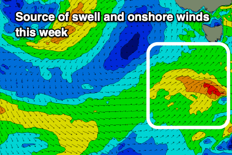
This afternoon’s change is linked to a trough clipping the region, with poor, strong SW winds due to persist tomorrow, likely holding from the W/SW tending SW on Wednesday though there should be a period of early W/NW winds across Clifton.
Swell wise, a weak frontal system projecting towards us today and tomorrow should produce a small to moderate sized increase in mid-period S/SW swell Wednesday, kicking to 3ft or so before easing Thursday from a similar size.
Conditions will improve Thursday as winds ease and tend W/NW through the morning, while the afternoon looks bumpy thanks to a SW breeze.
Expect the size to ease through Friday, further into the weekend with all the activity occurring north of our swell window over the weekend and into early next week.
In saying this, a very inconsistent W/SW groundswell is due Sunday, generated by a distant polar storm around the Heard Island region this evening and tomorrow, projecting a fetch of severe-gale W/NW winds towards the polar shelf. A slow 1-2ft wave may be seen and with persistent N/NE winds from Friday owing to the low stalling just west of us.
Longer term, depending on where the low sits we could see some small swell spreading out radially from it, but otherwise we rely on increasing zonal activity later next week. More on this Wednesday.