Make the most of later week

Southern Tasmanian Forecast by Craig Brokensha (issued Monday April 28th)
Best Days: Keen surfers Friday, beaches Saturday morning, keen surfers Tuesday and Wednesday mornings
Features of the Forecast (tl;dr)
- Strong S/SW winds tomorrow with a localised windswell
- Small mid-period S/SW swell Wed with mod-fresh SW tending S/SW winds
- Easing surf Thu with N/NW tending variable winds
- New SW groundswell Fri with a reinforcing pulse for Sat AM, easing
- N/NW tending N/NE winds Fri, N/NW tending E/NE Sat
- Tiny surf from Sun
Recap
Saturday started clean and small but our new mix of SW swells built quickly and strongly through the day, peaking into the late afternoon. Yesterday was clean all day with easing levels of swell, down again further today.
This week and weekend (Apr 29 - May 4)
Following a fairly active period of surf across the state, the coming week is a little slower before really bottoming out into the weekend and early next week.
This is thanks to the Southern Ocean storm track swinging from its focus south of us this week more up towards Western Australia from the weekend, north of our swell window.
Looking at tomorrow and a trough will bring poor, strengthening S/SW winds along with some localised windswell.
The polar front linked to the trough should also bring some better mid-period S/SW energy on Wednesday to 2ft or so but with lingering, fresh SW tending S winds.
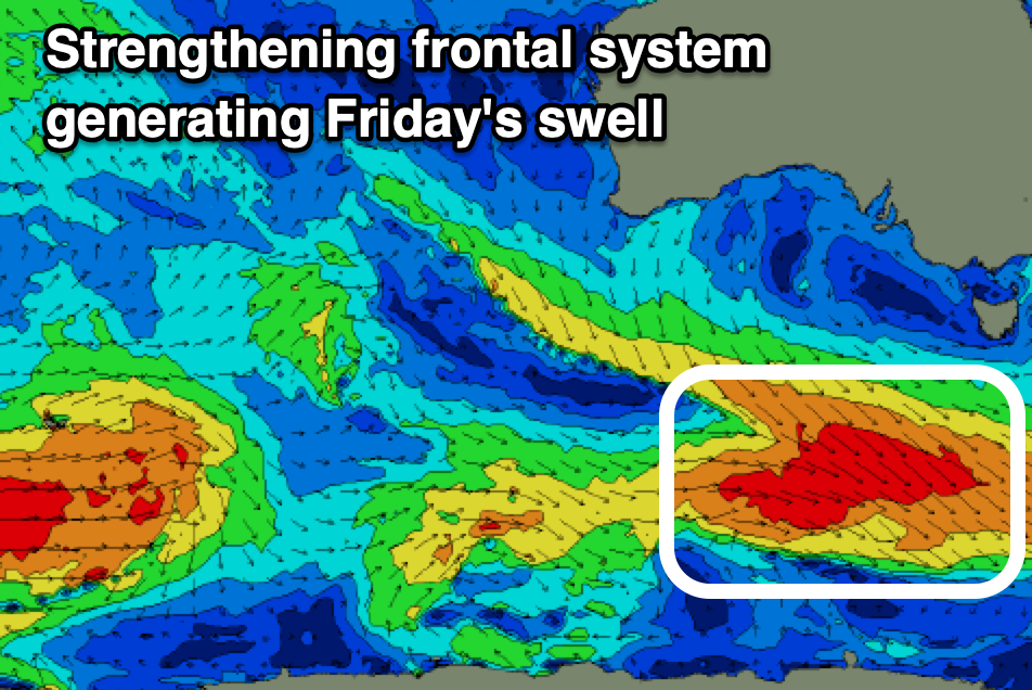
Thursday will be cleaner but the size looks minimal and back to 1-1.5ft, while come Friday a good new mid-period SW swell is on the cards.
This will be generated by a strengthening frontal system projecting towards the polar shelf Wednesday/Thursday, with fetches of W/NW gales due to generate some new SW groundswell Friday to 2ft+, easing slowly Saturday from a similar size.
Local winds Friday look great all day and N/NW tending weak N/NE with Saturday playing out similarly with E/NE winds into the afternoon.
Make the most of these days as from Sunday the swell will bottom out with not much in the way of surf due next week until Wednesday/Thursday when the inconsistent westerly swell from WA arrives. More on this Wednesday.