Get in tomorrow ahead of onshore winds

Southern Tasmanian Surf Forecast by Craig Brokensha (issued Monday September 26th)
Best Days: This evening, tomorrow, Saturday and Sunday
Features of the Forecast (tl;dr)
- Tiny Mon AM, with a new W/SW groundswell into the PM, peaking Tue
- Variable winds tomorrow
- Reinforcing mid-period SW swell Wed but with strong S/SW winds
- Mix of swells Thu and Fri with strong S/SE winds Thu, fresh Fri
- Easing surf Sat with N tending NE winds
- Inconsistent SW groundswell arriving later Sat, peaking Sun with N/NW winds
Recap
Poor surf with a mix of new W/SW groundswell and localised windswell but with strong onshore winds Saturday.
Yesterday conditions cleaned up nicely with a mix of easing swells from 1-2ft, tiny this morning.
This afternoon we're seeing a slight lift in long-period W/SW groundswell energy with 2ft sets now showing across Clifton with variable winds.
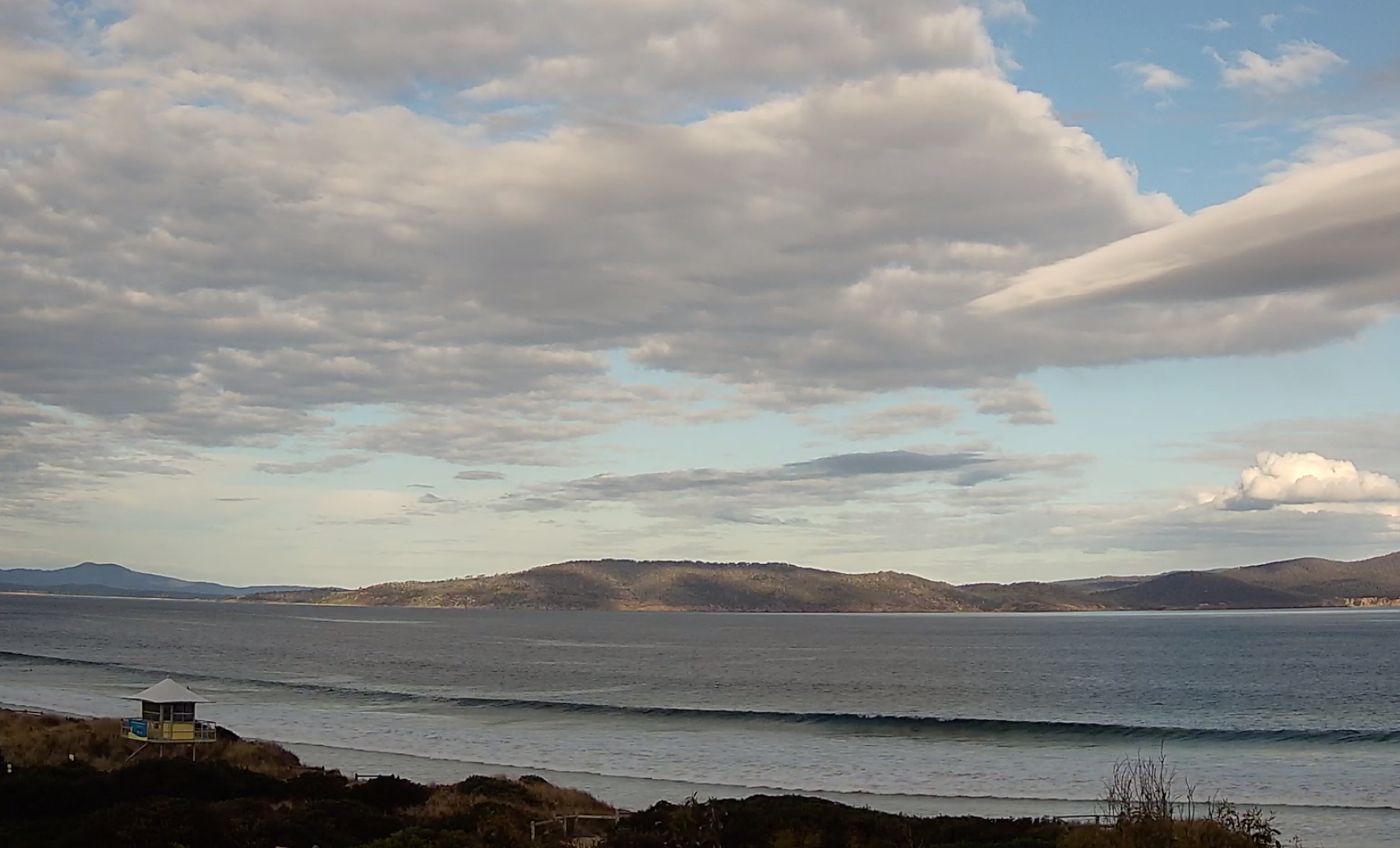
Strong lines of new swell this afternoon on the new Clifton cam
This week and weekend (Sep 27 – Oct 2)
This afternoon's slow increase in W/SW groundswell should hold into tomorrow morning with a touch more consistency in the 2ft range along with variable winds. The morning looks cleanest but the afternoon looks doable as well.
 2ft+ sets are due to come in Wednesday, generated by a fetch of W/SW around a polar low that formed off the back of the system linked to this afternoon's increase in size.
The only problem on Wednesday will be the local winds as a trough edges in from the west.
It unfortunately looks like winds will go strong S/SW before dawn, creating poor conditions with poor S/SE winds persisting into Thursday as the trough forms into a low to our north-east.
This will spoil some small, additional W/SW swell energy into the end of the week, generated by a low to the south-west of Western Australia.
 Sets to 2ft are again due Thursday afternoon and Friday but with winds remaining fresh from the S/SE into the end of the week. No major swell is expected by the onshore winds, and we'll hopefully see winds go N'ly on Saturday but with an easing SW swell from 1-2ft.
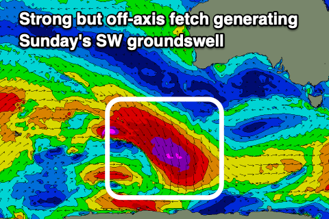
Into Sunday we've got a tricky but good looking SW groundswell due, generated by an off-axis fetch of gale to severe-gale NW winds projecting south-east towards the polar shelf over the coming days.
The swell off this fetch should spread radially up and into us later Saturday, peaking Sunday to 2ft+ or so. Winds look favourable and offshore but we'll have to confirm this Wednesday.
Comments
Nice work on the new additions Craig and co.
Cheers, Horace.