Motion in the ocean from early next week

Southern Tasmania Surf Forecast by Craig Brokensha (issued Friday 31st January)
Best Days: Tuesday morning, Wednesday morning, Thursday morning, Friday morning
Recap
Tiny surf yesterday and today.
This weekend and next week (Feb 1 - 7)
The weekend will remain void of swell and the small mid-period W/SW swell on the cards for next week now looks tiny. A couple of weak polar fronts will push too far north and out of our swell windows on the weekend, with the best chance for a wave being Tuesday morning in the wake of the front Monday.
A weak SW fetch should generate 1-2ft of SW swell Tuesday morning and winds look OK and W/NW early before shifting SW mid-late morning.
We then look to the S/SE swell from Tuesday through Thursday next week, generated by a persistent fetch of strong to gale-force S/SE winds through our south-eastern swell window from yesterday afternoon through tomorrow afternoon.
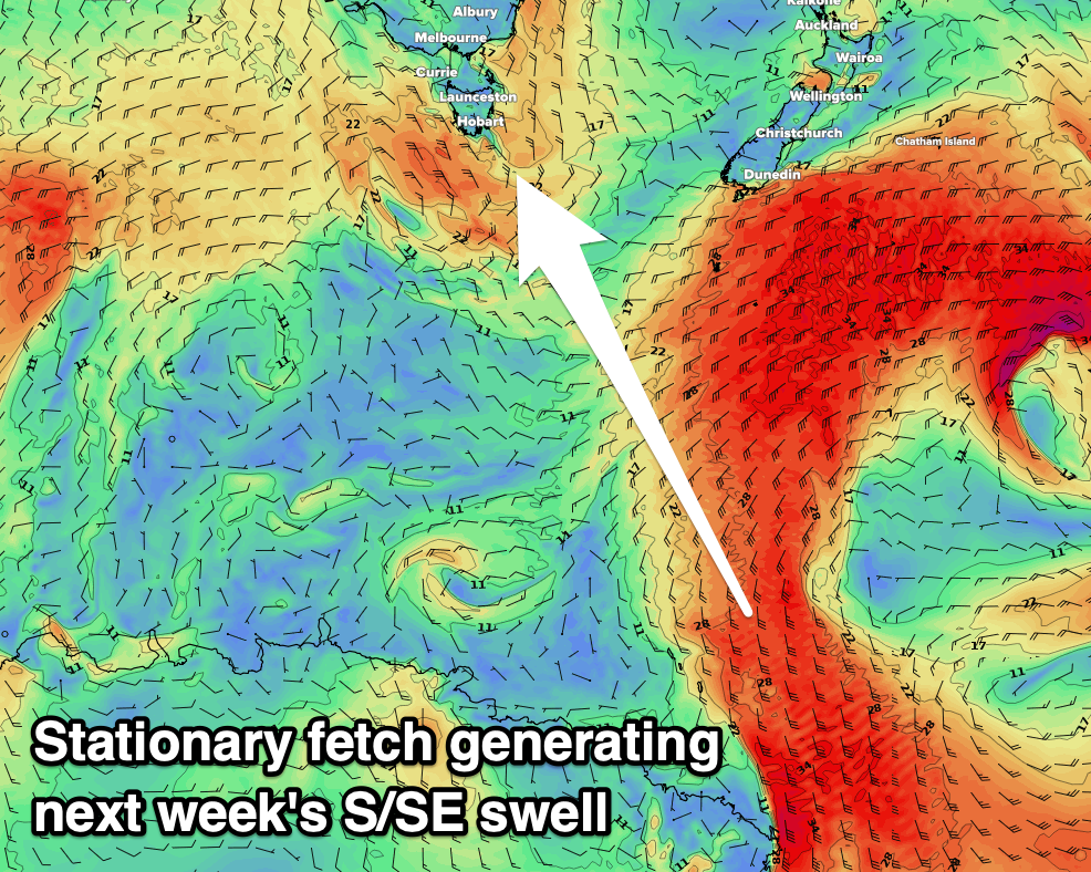 The strongest and best fetch of winds should develop early tomorrow, generating the best spike in size for Tuesday afternoon and Wednesday morning, likely to 3ft on the sets across Clifton.
The swell should then ease into Wednesday afternoon, smaller Thursday and down from 2ft.
Winds look favourable and W/NW-NW Wednesday morning ahead of S/SE sea breezes, variable Thursday as the swell eases.
As the S/SE swell eases a good new SW-S/SW groundswell is due, generated by a good polar front develop south of WA early next week and projecting east through the coming days.
The position and speed of this front is great with a good kick in swell to 3ft on Thursday morning, easing through the day and smaller easing 2ft sets on Friday. We'll have a closer look at this on Monday though. Have a great weekend!