Plenty of waves ahead, though next week looks complex

South-east Queensland and Northern NSW Surf Forecast by Ben Matson (issued Wed 4th May)
Forecast Summary (tl;dr)
- More of the same on E'ly swell Thursday, easing Friday, though a little slow at times
- Light winds and sea breezes in the north both days; N/NW winds Thurs across the MNC tending S'ly on Fri
- Tricky weekend with developing S/SE winds with a coastal trough, but there'll be plenty of fun E'ly swells
- Complex outlook for mid-late next week onwards as a broad coastal trough dominates the region with plenty of wind, rain and swell
Recap
Super fun 3-4ft E’ly swells over the last few days, with a few bigger sets at the swell magnets. Light winds in general.
This week (May 5-6)
Just a quick update today as I’m filling in for Steve who’s covering Margs.
We’ve got more of the same for the next few days. Our current source of E’ly swell has remained steady out in the South Pacific, and although there’s a chance for a slight pulse from today, size should persist in and around the 3-4ft mark at exposed spots on Thursday (smaller running down the points). A slow easing trend will then set in on Friday.
Winds should be generally light and variable with afternoon sea breezes both days north from about Ballina, but along the Mid North Coast we’ll see light N/NW winds freshening on Thursday as a front approaches the southern part of the state, with a SW tending S’ly flow in its wake for Friday.
It won’t be terribly strong but will probably force you to hunt out northern corners on Thursday and southern corners on Friday.
This weekend (May 7-8)
Easterly swells will bottom out a little on Saturday though remain quite fun with clean 2-3ft sets at exposed beaches in Northern NSW and SE Qld, a little smaller elsewhere. Conditions should be generally OK across most coasts with light winds, though a developing trough somewhere between Coffs and the border will probably cause winds to pick up from the south at some point.
A minor increase in E’ly energy is then expected on Sunday thanks to a brief strengthening of the easterly flow south-east from Fiji at the moment, but the sets will be very inconsistent thanks to the distant source.
Additionally, the coastal trough will start to influence the region with gusty S/SE breezes expected in some regions through the day. Current guidance suggests this is more likely in Far Northern NSW and SE Qld than the Mid North Coast, but we’ll refine this outlook on Friday.
Either way, an increase in local windswell is also likely.
Also on the cards for late Sunday is a possible south swell for the Mid North Coast, originating from a deepening cut-off low right over the top of Tasmania on Friday, which looks to be slow moving into Saturday, and will remain outside our swell window until Saturday night at the earliest.
By early Sunday we should see two fetch of interest - one exiting eastern Bass Strait, the other off the SE tip of Tasmania, and the resulting south swells should reach the Lower Mid North Coast by mid-late afternoon with 3ft+ sets on dark ahead of a peak on Monday. Of course, local winds will dictate whether this is workable or not.

Next week (May 9 onwards)
Sunday’s south swell should show best on Monday with 3-4ft sets at south facing beaches across the Mid North Coast, but smaller across remaining Northern NSW coasts and very little showing in SE Qld. Locations not open to the south will be much smaller.
We’ll also see a small undercurrent of persistent E’ly swell next week, though Sunday’s local trough will probably add some unwanted short range noise into the mix too. With likely S/SE winds, the points will probably offer the only options.
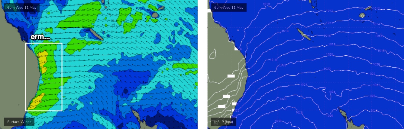
The main feature on the synoptic charts for next week is a deepening coastal trough across Northern NSW and SE Qld that’ll gradually envelop the greater East Coast by mid-week. As a minimum, this should lead to a punchy increase in short-mid range E/NE swell from about Wed/Thurs onwards, though local winds are likely to be an issue. And, expect quite a bit of rain too.
It’s still quite some time away though and we’ll see the models move around between now and then, but for now the long term outlook is shaping up to remain quite active from the eastern quadrant.
See you Friday!
Comments
Mbah wave buoy finally back up.
https://www.qld.gov.au/environment/coasts-waterways/beach/monitoring/wav...
Noice!
Thanks Sprout. I've been missing her.
Hopefully get some interesting readings next week
Are we looking at a bank buster on the gc?
Not at this stage no.
Models say otherwise currently. You reckon they are overcooked?