Windy, small week of surf
Monday, 13 November 2023
Windy, small week of surf
Monday, 13 November 2023
A small lift in S/SW groundswell is due tomorrow, easing Wednesday but with strong winds.
A small lift in S/SW groundswell is due tomorrow, easing Wednesday but with strong winds.
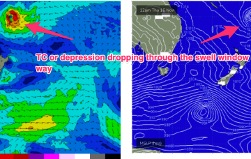
In addition the tropical depression or TC (Mal) which is expected to track SE through the swell window Wed/Thurs is expected to send some small E/NE swell our way. It’s a tricky, compact free-standing system but we can reasonably expect some 3 occ. 4ft sets Sat into Sun with revision to come this week.
The coming period looks average with large swells on the South Coast spoilt by onshore winds.
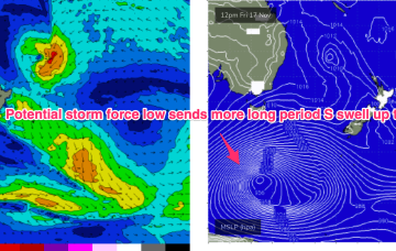
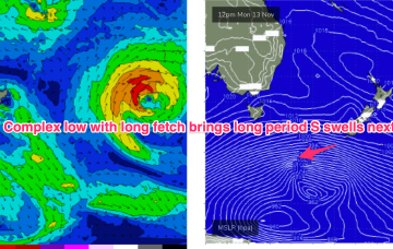
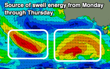
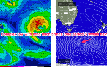
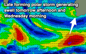
Another powerful low tracking into the Far Southern Tasman- this time at potential storm force- sends more uncommonly long period S swell up the NSW Coast (although better aimed up the Tasman Sea pipe towards Fiji).
The coming forecast period is overactive swell wise, but winds will be tricky to work around.
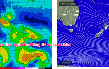
No great change to the weekend f/cast. The N’ly fetch reaches peak strength o/night and into Sat morning with a corresponding peak in NE windswell expected.
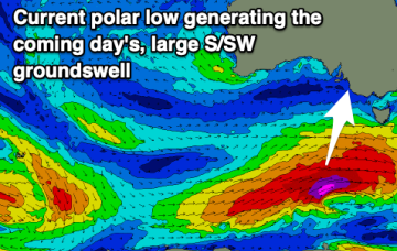
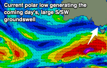
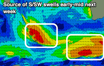
Much stronger frontal activity in the Far Southern Tasman tied to a deep, slow moving low will provide some long period S’ly groundswell pulses next week, favouring NENSW, although winds are looking very tricky around a troughy pattern.
Tomorrow looks tiny, but some good swell is due from Sunday and more so next week though with tricky winds.
Much stronger frontal activity in the Far Southern Tasman tied to a deep, slow moving low will provide long period S’ly groundswell pulses next week, although winds are looking very tricky around a weak, troughy pattern.
Today's building swell will ease slowly tomorrow, further Sunday under strong morning offshore winds. Next week looks slower but fun up until Wednesday.