Poor run of winds, spoiling a good swell
Friday, 14 January 2022
Poor run of winds, spoiling a good swell
Friday, 14 January 2022
We've got an average run of winds and conditions, spoiling a good quality groundswell next week.
We've got an average run of winds and conditions, spoiling a good quality groundswell next week.
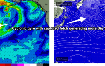
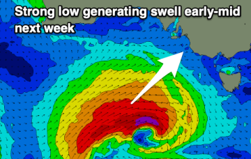
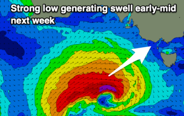
Into next week and another large cyclonic gyre forms over the North Pacific on the weekend/early next week. Gales to severe gales slingshot along the edge of the gyre, with a captured fetch reaching closer than 1000nm of Hawaii by Mon.
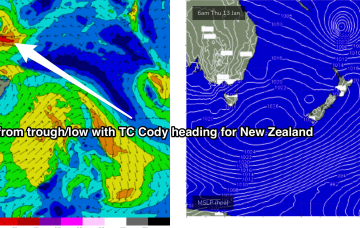
In the tropics TC Cody is drifting south through the South Pacific window , spraying the NSW/QLD coast with swell. The fetch is not well aimed for NETas but radial spread from the source should see some inconsistent 3-4ft sets through Mon, into Tues with winds much better on Mon.
Tiny surf to end off the week and weekend, more active next week though onshore.
Breaks with exposed access to the east will see better quality E swell through Thurs and Fri from TC Cody as it drifts south from Fiji towards the North Island.
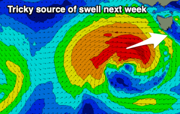
Current ASCAT (satellite windspeed) passes show a healthy fetch of E’ly winds flanking TC Cody as drifts south/south-east of the area between Fiji and New Caledonia towards the North Island.
The slow outlook continues but there'll be one fun day on the weekend and also later next week.
Current ASCAT (satellite windspeed) passes show a healthy fetch of E’ly winds flanking a tropical low as drifts south of the area between Fiji and New Caledonia towards the North Island.
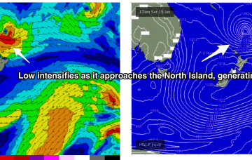
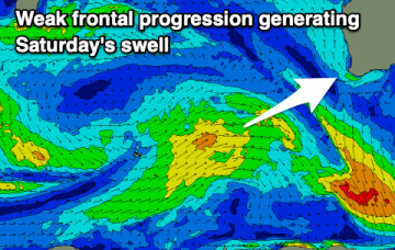
There's nothing significant for the end of the week and weekend but we're looking at a better SW groundswell next week, though the winds..
The surf will clean up across the beaches over the coming days but there'll be no decent swell with any power or size. We've got a stronger swell due next week though the winds are an issue.