Stacks of mid-range swell ahead
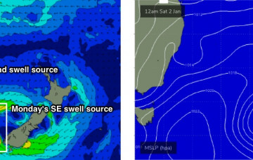
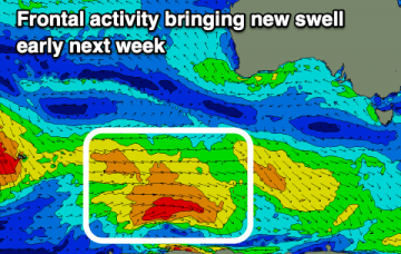
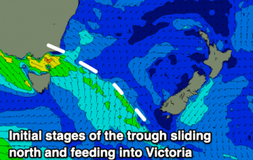
The main synoptic features right now are two surface troughs, one off the Central Qld coast and the other off the Mid North Coast. More in the Forecaster Notes.
The main driver for today’s onshore breeze is the squeeze between a trough off the Mid North Coast, and a high pressure system in the lower Tasman Sea. More in the Forecaster Notes.
Nothing to surf over the coming days before we see a bit more size to a localised windswell through the weekend and next week.
The South Arm will remain active over the coming period but there are no standout days and winds will be dicey and tricky at times.
A run of favourable morning winds, if not a bit blowy at stages with mixed swells, mostly below what's being seen today. Potential for next week.
There's nothing too exciting over the coming forecast period with persistent onshore winds across the South Coast and no decent west swells for the Mid.
The beaches are looking fun for a selection of the coming period with peaky conditions and a mix of swells.
A reasonable ridge is building through the lower Coral Sea, and will extend out across the Northern Tasman Sea over the coming days. This will be a useful source of E’ly swell for most coasts. More in the Forecaster Notes.
In short, it’s shaping up to be a nondescript week of slow, peaky beachies with conditions ranging between kinda-alright and not-really-that-great-to-tell-you-the-truth. More in the Forecaster Notes.
Nothing major this week with today's swell due to fade, replaced by weak local windswells. There's some improved potential for next week.