If only the forecast was an April fools joke
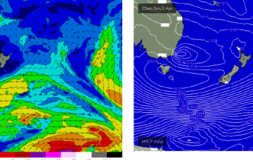
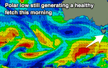
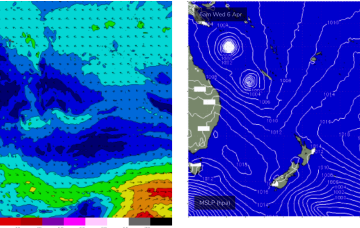
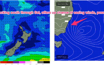
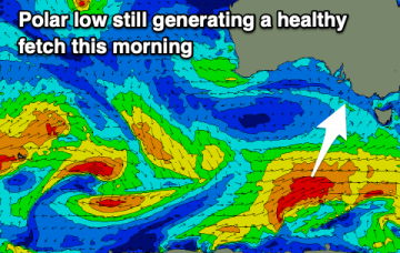
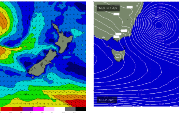
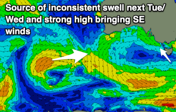
A poor forecast for autumn with no reliable, quality surf days. Better winds and swells are likely longer term.
Severe gale force winds are proximate to the NSW Coast and are well placed to generate plenty of S swell for Tasmania before a better angled ESE to E swell hits on the weekend.
An unseasonal run of south to south-east winds spoil good incoming swells.
All this is too far south and behind the curve of the QLD Coast and Fraser Island to produce any surf for the CQ region, so we’ll see the tiny surf that was on offer today contract back to near flatness for the rest of the week.
Today's underperforming swell will fade into the end of the week, with a fun W/SW swell due to build on the weekend.
A trough of low pressure associated with the current sub-tropical low deepens rapidly through tomorrow in response to the influx of cold air, forming a storm force low pressure system off the NSW Central Coast overnight Thursday into Friday.
The coming period will see plenty of surf but poor conditions for the South Coast and generally tiny waves on the Mid Coast.
Poor conditions over the coming days with plenty of swell but strong, persistent south-east winds.
The weekend looks juicy. Whilst the Tasman low is not ideally aimed at Tasmania, E to SE winds feeding into the low are expected to generate a strong E’ly swell for the NE Coast.