Windy, cold weather inbound
Monday, 7 July 2025
Windy, cold weather inbound
Monday, 7 July 2025
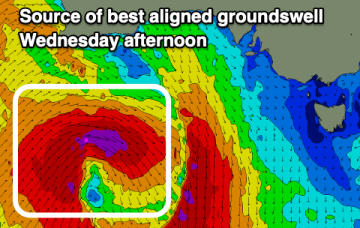
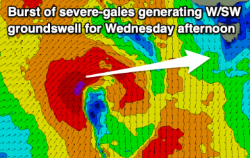
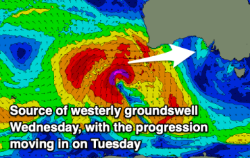
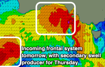
A strengthening frontal progression is moving in from the west and will hit tomorrow morning.
A strengthening frontal progression is moving in from the west and will hit tomorrow morning.
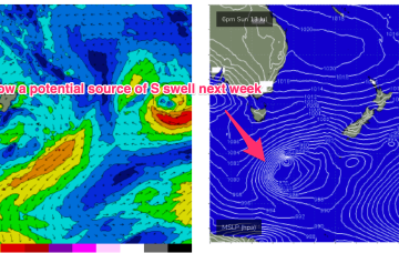
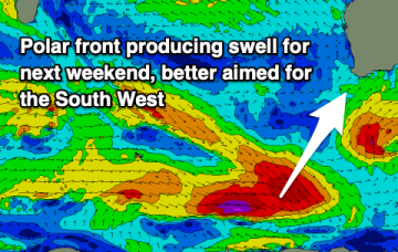
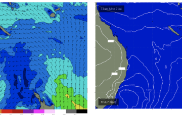
High pressure is well up over the centre of the continent with as weak, troughy area of low pressure moving offshore from the south coast dragging a cloud band with it and offering a W’ly flow in it’s wake. That W’ly flow looks to continue through the working week as a series of cold fronts sweep across the SE of the country.
High pressure is well up over the centre of the continent with as weak, troughy area of low pressure moving offshore from the south coast dragging a cloud band with it and offering a W’ly flow in it’s wake. That W’ly flow looks to continue through the working week as a series of cold fronts sweep across the SE of the country.
The Surf Coast will be the pick over the coming period with fun levels of swell and mostly clean conditions.
Make the most of tomorrow before it goes raw and wild over the weekend, with the metro regions having a couple of windows mid-week.
Make the most of tomorrow morning with next week expected to be mostly small to tiny.
Weak high pressure is drifting up over NSW/QLD with a low in the Tasman moving away to the east as it weakens. No signicifant swell generating winds in the Coral Sea so surf is tiny/flat and likely to remain that way right through the weekend and next week.
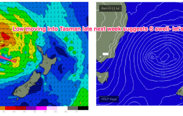
The trough is linked to a broad low which moves off the South Coast o/night Sun into Mon and does aim up some useful swell generating winds for NETas.
The weekend will offer small waves across both regions, with next week expected to be come large and windy across the Mid Coast.
The complex, coastal low is now dissipating and drifting towards New Zealand while high pressure drifts NE to sit over sub-tropical NSW/SEQLD tomorrow before entering the Tasman on Sunday with a broad low pushing across the interior of Victoria and NSW behind it.