Plenty of SE swell on the way
Monday, 29 June 2020

Plenty of SE swell on the way
Monday, 29 June 2020
At this stage there’s no reason to deviate from Friday’s estimate. More in the Forecaster Notes.
At this stage there’s no reason to deviate from Friday’s estimate. More in the Forecaster Notes.
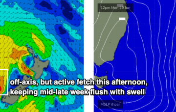
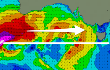
The swell source was very strong and sustained - and indeed, still is - however it was off axis from our swell window, and this will affect not only the size of the swell reaching Southern NSW compared to its northern counterparts but also the consistency. More in the Forecaster Notes.
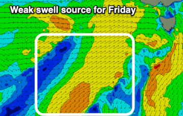
Nothing significant this period with some potential from the weekend but more so later next week.
The poor outlook continues with either tiny and clean waves or a bit more size, but weak windswells and onshore.
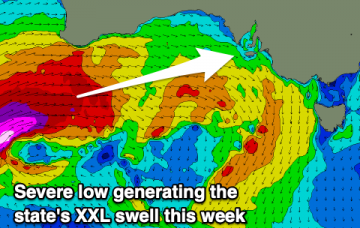
A slight drop in the wind and XL swell energy tomorrow but picking up again Wednesday as winds slowly improve.
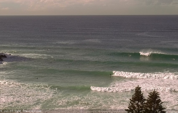
A significant swell is on the way but it'll be windy and you'll have to try more protected spots for a wave.
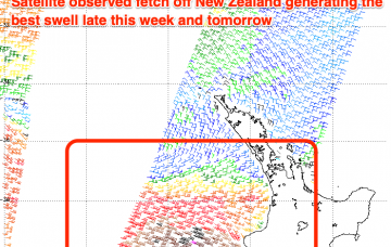
The models are struggling to resolve the incoming swells which will be very west and not well aligned for our swell window at all. More in the notes.
Having confidence on the likely size from this new SE swell is quite difficult. More in the Forecaster Notes.
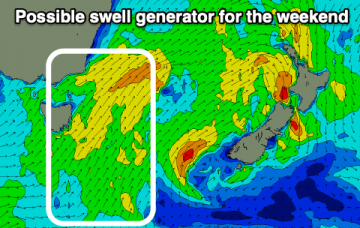
There’s been yet another rejig in the model output regarding a new surface low in the lower Tasman Sea this weekend. More in the Forecaster Notes.
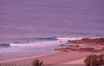
Make the most of the weekend and a good E'ly swell before things settle into next week.