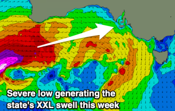
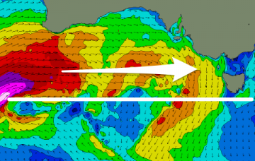
XXL swell due to peak mid-week
Monday, 29 June 2020

XXL swell due to peak mid-week
Monday, 29 June 2020
A slight drop in the wind and XL swell energy tomorrow but picking up again Wednesday as winds slowly improve.
A slight drop in the wind and XL swell energy tomorrow but picking up again Wednesday as winds slowly improve.
A significant swell is on the way but it'll be windy and you'll have to try more protected spots for a wave.
The models are struggling to resolve the incoming swells which will be very west and not well aligned for our swell window at all. More in the notes.
Having confidence on the likely size from this new SE swell is quite difficult. More in the Forecaster Notes.
There’s been yet another rejig in the model output regarding a new surface low in the lower Tasman Sea this weekend. More in the Forecaster Notes.
Make the most of the weekend and a good E'ly swell before things settle into next week.
Not much to talk about this period, so try the East Coast Forecaster Notes again.
Windy and large to extra-large surf on the way, improving from mid-week.
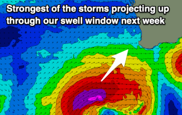
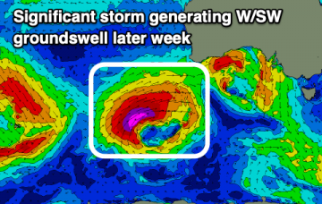
Easing and fun surf over the weekend ahead of a slow few days. New W/SW swells building mid-late week with the possibility of a very large event.
Generally favourable winds and conditions with a new but easing swell on the weekend. Slow ahead of some stronger activity late next week.