Good swells from the north-eastern quadrant
Monday, 15 April 2019
Good swells from the north-eastern quadrant
Monday, 15 April 2019
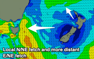
Plenty of swell out of the N/NE and E/NE over the coming period and with workable winds.
Plenty of swell out of the N/NE and E/NE over the coming period and with workable winds.
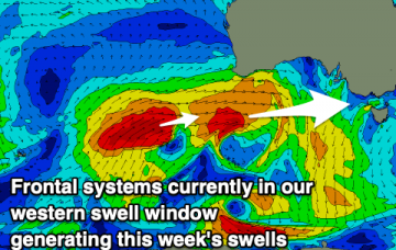
Our Easter swell is being generated by a broadening E’ly fetch atop a large, stationary Tasman high, that’s expected to remain slow moving inside our swell window up until the weekend. More in the Forecaster Notes.
A generally tiny run of swell with one day standing out to offer the most surfable waves.
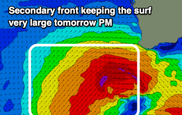
XXL surf over the coming days with poor conditions, improving as it eases. Another large swell later week with average winds.
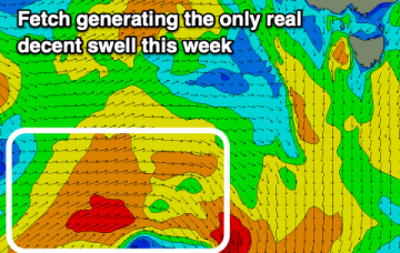
There’s really just one swell event worth considering this forecast period. More in the Forecaster Notes.
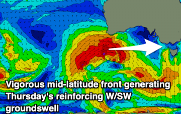
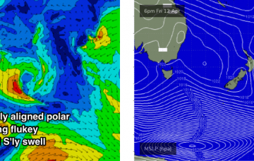
Back to back mid-latitude fronts will generate strong westerly swells with favourable winds for both coasts at stages.
A very tricky forecast period but in general best suited to the beach breaks with average swells and winds for the Surf Coast.
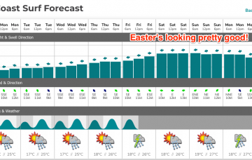
There’s been quite a few changes in the model guidance ever the last 48 hours: Thursday morning saw the Easter swell disappear completely.. this morning’s models jumped it back up to 6ft! More in the Forecaster Notes.
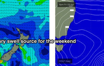
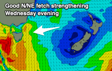
We’re looking at continuing small swells, generated by flukey systems on the peripheries of our swell windows, ahead of a long lived E/NE swell event. More in the Forecaster Notes.
A small pulse of S'ly swell for tomorrow morning and then poor until some better N/NE swell builds mid-week.