Make the most of this morning and tomorrow
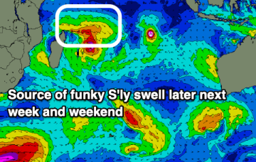
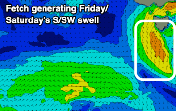
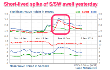
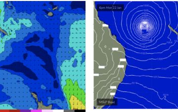
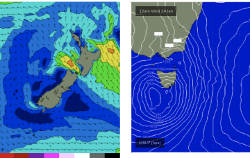
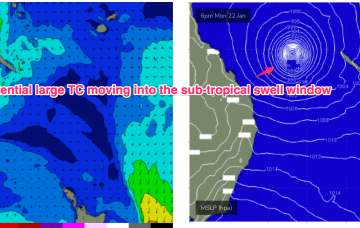
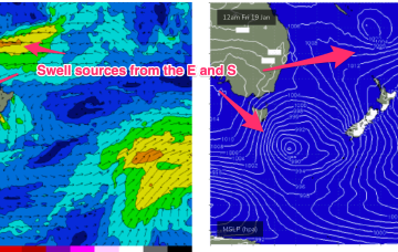
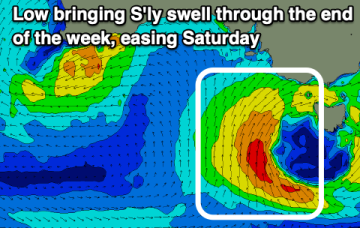
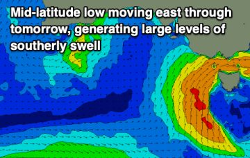
We've got a poor outlook ahead with smaller, weak swells and dicey winds. Hit up this morning and tomorrow on the beaches.
Tricky and average outlook across all locations.
Fun surf days to come dodging Friday.
There's no major swells due and winds are dicey for the coming period.
In the South Pacific we have a retrograding trough of low pressure along a tradewind band and finally,the Northern Australian Monsoon (NAM) is in full swing and a tropical low is expected to bud off the end of the monsoon trough into and over the weekend, with a reasonable likelihood of cyclogenesis into next week. Still plenty of uncertainty there over intensity, track and surf potential but at least some model runs are starting to look favourable.
We’re midway through the current pattern with a high pressure cell near New Zealand directing fresh NE winds towards Tasmania, weakening trough in the Tasman and an approaching complex low SW of Tasmania.
In the South Pacific we have a retrograding trough of low pressure along a tradewind band and finally, the Northern Australian Monsoon (NAM) is in full swing and a tropical low is expected to bud off the end of the monsoon trough into and over the weekend, with a reasonable likelihood of cyclogenesis into next week.
A stalling low will produce plenty of size out of the south over the coming days with workable windows down South.
Make the most of the coming days as the outlook for next week is poor.