Extended run of favourable conditions
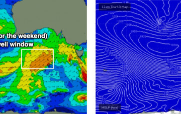
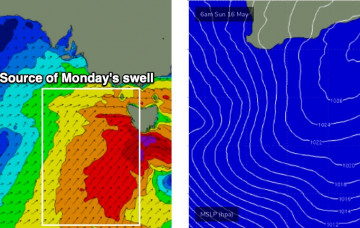
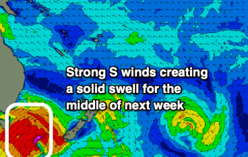
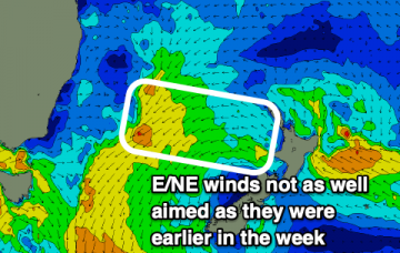
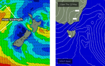
A high pressure system to the south of the state and a deepening trough well east of WA will maintain moderate to fresh E’ly winds across the region.
Check the forecast graph - we’ve got ten consecutive days of windy conditions coming up, initially related to an amplifying Long Wave Trough steering a succession of vigorous cold fronts across the state.
Saturday looks to be post-frontal in the wake of Friday night’s change, whilst Sunday morning will see generally light variable winds as another front approaches from the south, bringing moderate W/SW winds into the afternoon.
We’re at the cusp of five days of windy conditions as an amplifying Long Wave Trough steers a succession of vigorous cold fronts into the Victorian coastline.
The last of the E swell will fade into the weekend before S swells make a return.
Last of the E swell to fade into the end of the week while S swells make a return for the weekend.
The broad scale forecast trend is relatively straightforward, as we have one significant swell event due Thursday, and then a steady easing trend for three days thanks to a blocking pattern.
Today’s southerly change is expected to stall off the Southern NSW coast as a trough, and then reorientate nicely within our swell window.
The final front/low in the Southern Ocean sequence is expected to track below WA on Friday, and as it’ll hug the ice shelf, will be much better positioned within the South Arm’s swell window.
Another pulse of E swell will bring some more fun days of waves this week.