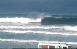
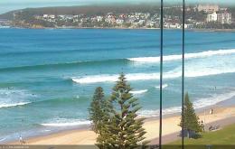
Average swells with less than ideal winds
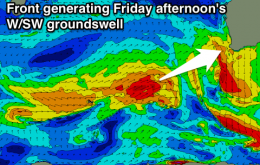
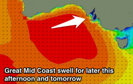
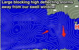
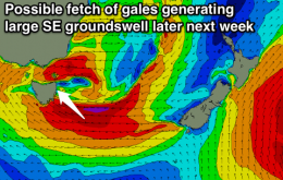
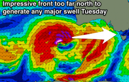
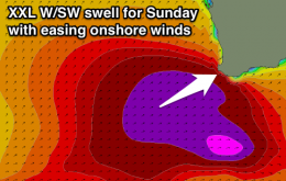
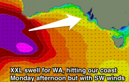
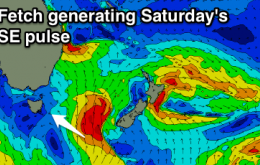
New inconsistent W/SW groundswell tomorrow and then short-range SW swell Wednesday with early W'ly winds, tending onshore. Fun SE swell for Saturday.
Easing W/SW groundswell with NE tending N'ly winds tomorrow, deteriorating further Wednesday. New mid-period W/SW swell with variable winds Thursday morning, better long-period SW groundswell building Friday with good winds. Average weekend.
Good Mid waves over the coming days, terrible down South.
Strong new W/SW groundswell tomorrow but with gusty S'ly winds, easing Wednesday as onshores persist. Slightly better E'ly winds Thursday with a new swell, better Friday as the swell drops under NE breezes. Small clean weekend.
Small kick in southerly swell tomorrow with offshore winds, flat until some interesting developments later next week.
The strong southerly groundswell currently pushing up along the Northern NSW will probably peak overnight, which is a shame as there’s a lot of size and strength in the water right now.
Good new SW swell for tomorrow afternoon, easing into the afternoon and further Sunday. Clean through this period, with a new W/SW swell Tuesday but with onshores.
Today’s strong southerly swell will ease rapidly overnight, and conditions should be clean for the early session with light offshore winds.
Large W/SW swell building tomorrow with strengthening onshore winds, becoming XXL Sunday with gale-force but easing onshore winds. Much better conditions due Monday as the swell eases from the XL range.
Mix of new swells tomorrow with offshore winds down South, easing temporarily Sunday ahead of a late pulse of strong new W/SW swell with N/NW winds. Large powerful W/SW groundswell building Monday but with onshore winds.