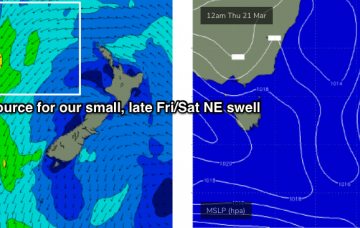
Patchy surf for the short term; much better long term
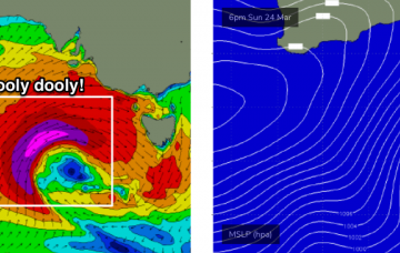
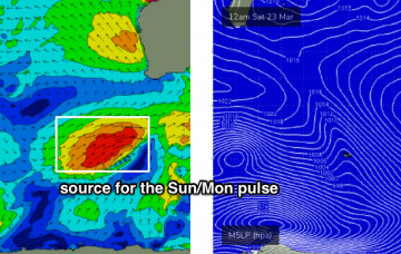
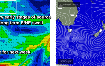
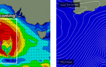
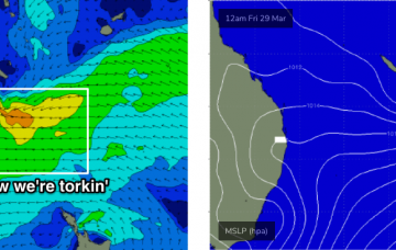
The extended period looks very good for most regions. More in the Forecaster Notes.
A tropical system near Fiji around Monday will slowly evolve into a decent swell generating system through the week. More in the Forecaster Notes.
With the low pressure system sitting west of Tasmania, we’ll also see a very large increase in stormy surf on Monday. More in the Forecaster Notes.
A complex series of powerful lows will develop south of the continent over the weekend, migrating through our near swell window into the start of next week and delivering a period of very large, windy surf for the state.
A series of powerful fronts and lows will develop on the eastern periphery of our Southern Ocean swell window today and tomorrow. More in the Forecaster Notes.
A series of powerful, complex lows will cross the Tasmanian region early next week, strengthening N’ly tending W’ly winds on Monday morning that could reach gale to storm force strength. More in the Forecaster Notes.
A complex series of powerful lows will track across Tasmanian longitudes from Monday onwards, delivering W/NW tending W’ly gales and building strong surf across the region.
There’s plenty of surf in store for the longer term period. More in the Forecaster Notes.
Our swell windows are devoid of any major synoptic activity, and with our recent glancing southerly swell now exiting to the north, we have to look towards peripheral swell sources for the short term. More in the Forecaster Notes.
A series of vigorous weather systems approaching the state this weekend are not expected to impact the coast until Monday. More in the Forecaster Notes.