Extended run of mediocrity ahead
Monday, 11 March 2019
Extended run of mediocrity ahead
Monday, 11 March 2019
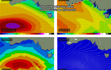
There’s a lot of interesting features on the long term charts.
There’s a lot of interesting features on the long term charts.
There’s a lot of interesting features on the long term charts, some of which are quite plausible, and some of which are much less certain and require a variety of circumstances to eventuate. More in the Forecaster Notes.
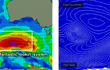
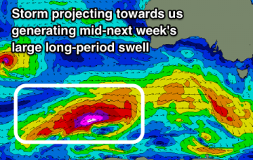
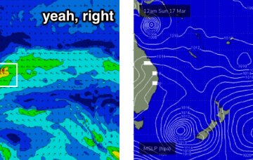
I really like the look of this system, its position relative to the coast is in the ‘goldilocks’ zone for the South Coast at least, reaching peak intensity between Margaret River and Adelaide longitudes, beginning to weaken as it approaches Victorian latitudes.
So, first day back in the Victorian driver’s seat for a while, and what do we have? Let’s take a quick look at the available data to see if the model guidance is still stacking up. More in the Forecaster Notes.
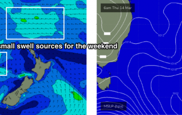
There’s not a whole lot of excitement on the forecast charts. But there will be waves if you’re keen.
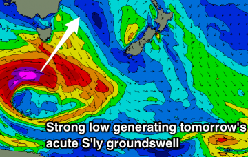
Only one real notable swell and that will be tomorrow but with dicey winds.
No change to the weekend outlook - it still looks pretty tricky.
No lack of surf over the coming period but winds will be tricky and variable.
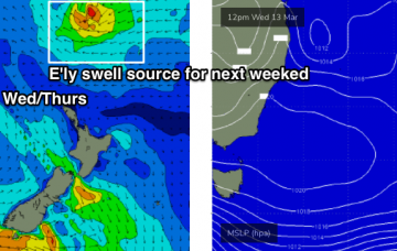
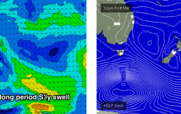
Slow ahead of a strong kick in new SW groundswell late Sunday, peaking Monday followed by a secondary large S/SW groundswell.
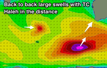
Good winds and a fun S/SW groundswell for the weekend with a large swell for next week with dicey winds for the South Coast.