Tricky west swells, best on the beaches
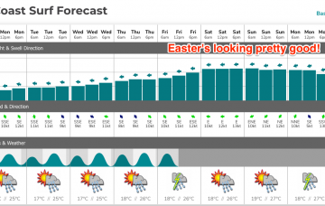
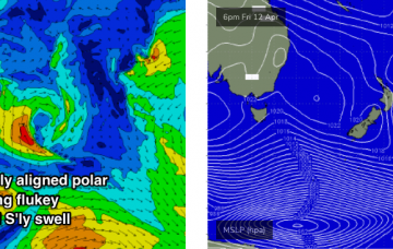
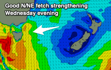
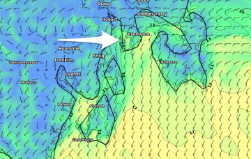
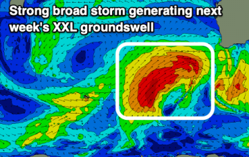
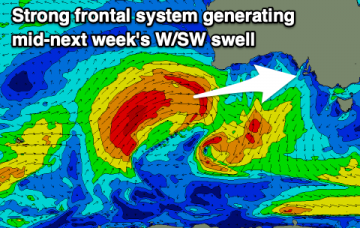
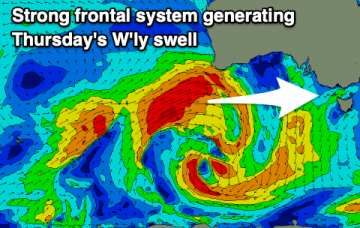
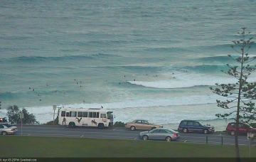
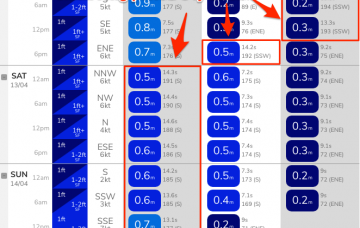
A very tricky forecast period but in general best suited to the beach breaks with average swells and winds for the Surf Coast.
There’s been quite a few changes in the model guidance ever the last 48 hours: Thursday morning saw the Easter swell disappear completely.. this morning’s models jumped it back up to 6ft! More in the Forecaster Notes.
We’re looking at continuing small swells, generated by flukey systems on the peripheries of our swell windows, ahead of a long lived E/NE swell event. More in the Forecaster Notes.
A small pulse of S'ly swell for tomorrow morning and then poor until some better N/NE swell builds mid-week.
Average conditions tomorrow morning with a new swell, cleaner as it eases Sunday. Small to tiny westerly swells most of next week.
Today's large W/SW groundswell will ease through tomorrow with great winds early, then we'll see onshore winds and developing XXL surf into early next week.
Light winds and generally small waves down South until mid-next week, while the Mid Coast will see a fun W'ly swell on the weekend.
Small flukey swells for the coming days ahead of a good W'ly groundswell later Wednesday and more so Thursday.
We’ve got some favourable synoptic charts on the boil for next week, thanks to the interaction between a coastal trough, a large, stationary high in the Tasman Sea and a broad region of low pressure through the eastern Coral Sea into the Tropical South Pacific.
No major swell events are expected in the short term, however we should see small waves from the south. Easter's still looking pretty good too! More in the Forecaster Notes.