Small swells with decent windows of clean conditions
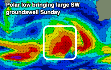
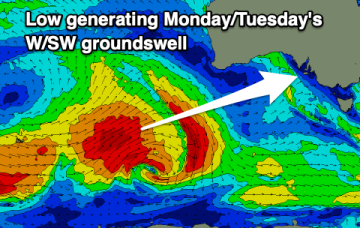
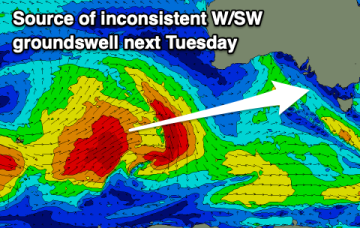
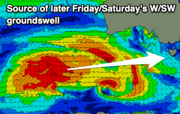
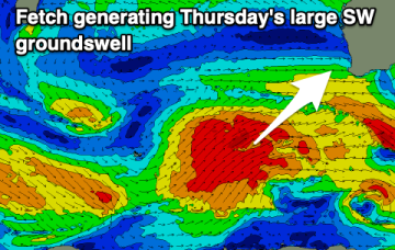
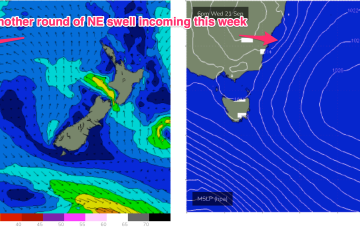
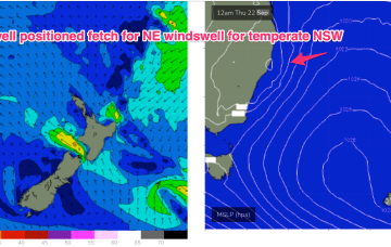
W/SW swells with a S/SE swell for the weekend and windows of decent conditions in between bouts of strong southerly winds.
The complex low and huge trough line (extending across most of Australia!) are still tracking across the interior as forecast, with a high in the Tasman generating a NE flow across the majority of the Eastern Seaboard. The pressure gradient is tightened as the low approaches with an increase in NE winds and swell expected through the end of the week
Large surf with better winds over the coming days before deteriorating from later Friday morning again.
The complex low and huge trough line (extending across most of Australia!) are still tracking across the interior as forecast, with a high in the Tasman generating a NE flow across the majority of the Eastern Seaboard. The pressure gradient is tightened as the low approaches with an increase in NE winds and swell expected through the end of the week.
Fun swells with favourable winds for both coasts over the coming days and weekend.
We've got varying but favourable winds over the coming days before things go a little pear shaped next week.
Slow waves but increasing slightly in size and power through the end of the week.
Large surf with dicey winds over the coming days, improving for all locations from Thursday.
We have a typical looking Spring pattern with a weak high over the NSW interior and some flabby fronts passing South of Tasmania. An approaching trough series and inland low adds action mid-week as it tightens the pressure gradient with a more southerly located high, developing a N’ly fetch off the NSW Coast and another round of chunky NE windswell making landfall from mid week.
We have a typical looking Spring pattern with a weak high over the NSW interior and some flabby fronts passing South of Tasmania. An approaching trough series and inland low adds action mid-week as it tightens the pressure gradient with a more southerly located low, developing a N’ly fetch off the NSW Coast and another round of chunky NE windswell favouring the Mid North Coast for most size.