Large westerly swells inbound but poor on the Mid

South Australian Surf Forecast by Craig Brokensha (issued Wednesday July 5th)
Best Days: South Coast tomorrow, South Coast protected spots Saturday and Sunday morning, South Coast all next week
Features of the Forecast (tl;dr)
- Large pulse of W'ly groundswell tomorrow with strong N tending NW winds, easing on the South Coast Fri
- Building mix of stormy swells on the Mid Fri with strong NW tending near gale-force N/NW winds
- Large mid-period W/SW swell for Sat on the Mid, easing Sun
- Moderate sized + swell building Sat PM down South, easing Sun
- Strong W/NW winds Sat, fresh W/NW tending W/SW Sun
- Slight drop in swell Mon with NW tending W/NW winds
- Moderate sized + SW groundswell Tue with N/NW tending variable winds
Recap
Great waves across the South Coast magnets yesterday with clean conditions and 2ft sets off Middleton, more 3ft across the magnets, while today the swell has dropped back a little. The Mid Coast has offered tiny wind affected waves for beginners.
This week and nexy (Jul 6 - 14)
We've got a strong pulse of W'ly groundswell due tomorrow across the state, generated by a severe low that has been battering Western Australia since the start of the week. A slow moving fetch of gale to severe-gale W/SW-W winds has generated the swell with it due to peak across the Mid Coast in the strong 3ft range while Middleton looks to offer 3-4ft sets (bigger down towards Goolwa).
The remnants of the low are expected to push north and across us through tomorrow, bringing strong N tending NW winds. This will favour the South Coast and create choppy conditions on the Mid.
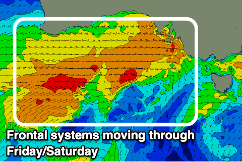
Come Friday, the groundswell is expected to ease but the next frontal system in a strong progression will move in quickly. This will bring strong NW tending near gale-force N/NW winds into the afternoon/evening, kicking up a building windswell across the Mid Coast followed by some new mid-period W/SW swell. Stormy 3-4ft waves are likely into the afternoon while the South Coast is due to ease back from 2-3ft.
Now, unfortunately the progression as a whole looks weaker and more northerly located, not ideal for the South Coast. This will result in large stormy waves on the Mid Coast but weaker mid-period energy down South.
Saturday looks to come in at a stormy 3-4ft on the Mid Coast with strong W'ly winds, dropping back to 3ft on Sunday with fresher W/SW-W winds.
The South Coast looks the pick with building mid-period energy Saturday afternoon to 4-5ft off Middleton, easing back from a similar size Sunday morning.
Winds should tend more W/NW across the South Coast Saturday and Sunday mornings, favouring protected spots, with W/SW winds likely into the afternoon Sunday.
Following the weekend's frontal activity, we've got a ton more mid-latitude frontal systems lining up with the swell not likely to drop below the 2ft range on the Mid Coast and 3-4ft down South through most of next week.
The next swell generating system will be a tight low generating a good spike in swell for Tuesday but we'll have a closer look at this Friday. Winds look to be generally out of the NW for most of next week as well which is great.