Large consistent S/SW swell for tomorrow and Saturday

Bali and Mentawais forecast forecast by Craig Brokensha (issued Thursday 8th September)
Best Days: Experienced surfers over the coming days, more manageable waves from Wednesday afternoon
This week and next (Sep 9 - 16)
Bali: The surf continued to pump yesterday, but into today a drop is due from the 5-6ft range across magnets, smaller into early tomorrow.
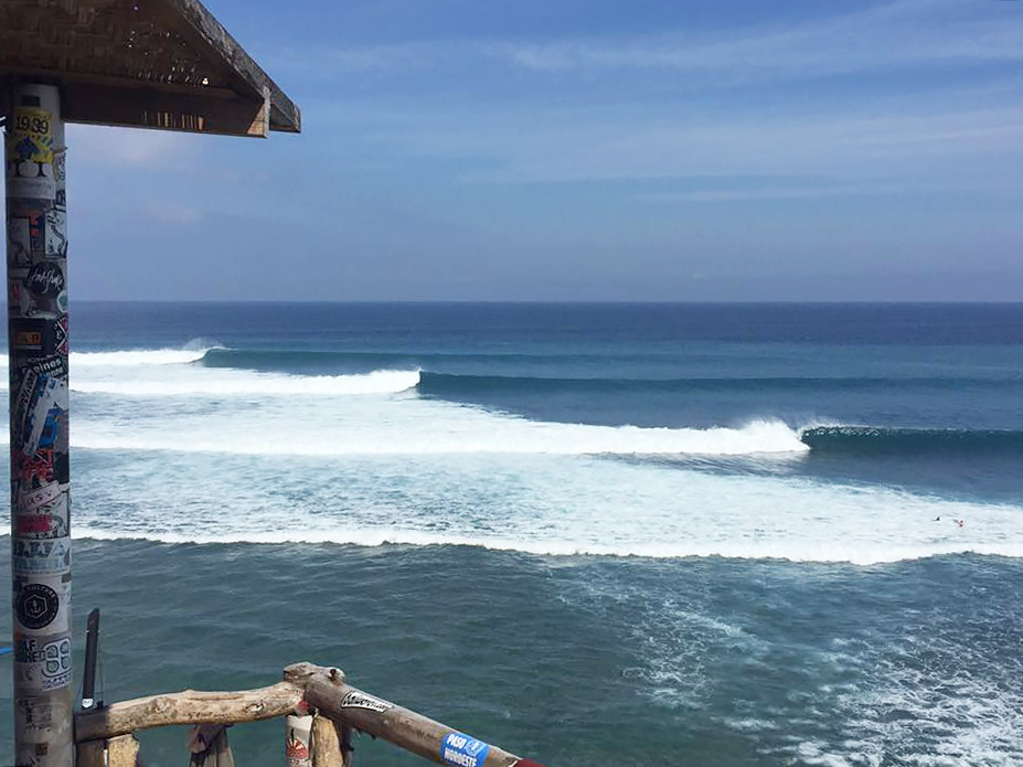
Uluwatu on fire, photo by Todd Goudie
There won't be much downtime tomorrow though, as a large consistent S/SW groundswell fills in. There's no change to the expected size with magnets expected to build from the morning, reaching 8-10ft by dark.
Saturday morning should see similar sized sets as a reinforcing S/SW groundswell fills in, easing into the afternoon and then further from 8ft+ Sunday morning.
The surf should continue to ease through Monday ahead of a late kick in new S/SW groundswell.
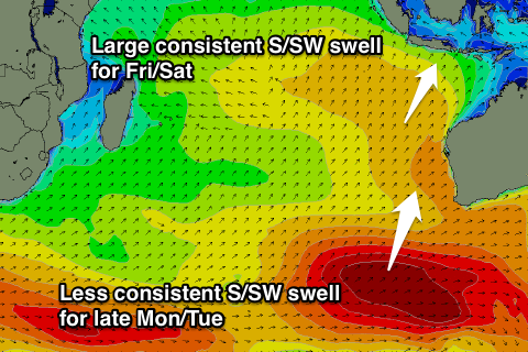 This groundswell will be less consistent than the coming days swell with it being generated by a vigorous polar low that's developed south-west of WA.
A fetch of severe-gale to storm-force W/SW winds are being generated in our southern swell window, with it arriving later Monday, kicking to 6-8ft late in the day, peaking overnight and easing from a similar size Tuesday morning, if not for the odd bigger set at times early.
A steady drop in size is due through the afternoon, further into the end of the week.
Longer term some inconsistent S/SW groundswell is due into next weekend and early the following week from strong but distant polar fronts.
Size wise each pulse looks to come in around an inconsistent 4-6ft across magnets, but more on this Tuesday.
Coming back to the winds, and gusty E/SE trades today should ease back into tomorrow and tend more SE weaker into Saturday and Sunday. We should see moderate to fresh E/SE winds kick up again from Monday, easing back again later next week.
16 day Bali Forecast Graph
16 day East Java Forecast Graph
16 day Sumbawa Forecast Graph
Ments: After excellent waves the last few days, the swell has eased back into this morning but it's only a temporary low point ahead of tomorrow's large S/SW groundswell.
There's been no real change to the expected size with exposed breaks due to build to a large consistent 6-8ft+ by dark tomorrow, easing from a similar size Saturday morning. Magnets across the more southern islands are likely to see 10ft bombs late Friday and early Saturday.
 The swell will ease through the afternoon and further Sunday from 6ft+, smaller Monday.
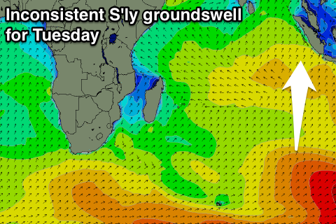
Later in the day Monday but more so Tuesday a new S'ly groundswell is expected, generated by a strong polar low that's currently south-west of WA.
A fetch of severe-gale to storm-force W/SW winds will be produced just within out swell window, with an inconsistent but good long-period S'ly groundswell coming in Tuesday morning to 5-6ft+ across south magnets.
The swell will ease quickly from later in the day, much smaller into the end of the week.
Conditions are looking good from tomorrow with variable winds for the most part, increasing a touch from the W/NW into Monday.
Longer term some inconsistent S/SW groundswell is on the cards for next weekend from frontal activity along the polar shelf. Inconsistent 3-5ft sets are due into Saturday afternoon and Sunday, with some similar pulses on the cards for the following week. More on this Tuesday.
16 day Mentawai forecast graph
16 day Nias forecast graph
16 day South Sumatra forecast graph