Good period of fun swells with light winds

Nias, Mentawai, South Sumatra forecast by Craig Brokensha (issued Tuesday 26th October)
Best Days: Every day over the coming period
This week and weekend (Apr 27 – May 1)
Pumping waves Sunday with a peak in new S/SW groundswell, easing back through yesterday ahead of a new pulse of S/SW groundswell today.
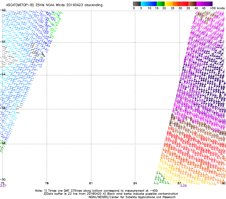 We should see this groundswell ease back into tomorrow morning, but through the afternoon a new acute S'ly groundswell is due, generated by an intense mid-latitude low over the weekend (satellite observations pictured right).
Exposed south facing breaks should kick to a strong 6ft on the sets, easing back from 5-6ft Thursday morning, further down from 4-5ft Friday morning with the weekend seeing smaller 3ft+ waves.
Variable winds are due every day over the coming days, creating clean glassy conditions.
Next week onwards (May 2 onwards)
Eastern Indonesia will see a series of good S/SW groundswell pulses from Monday through most of next week, but the frontal systems generating these are too far east and on the edge of out southern swell window.
Instead we'll see refracted and smaller S'ly swell energy, the first to 4-5ft Monday afternoon at south facing breaks, with a secondary kick Tuesday afternoon to a similar size, easing back through Wednesday and Thursday.
 At the same time some new and better aligned SW groundswell is due to fill in later Monday but more so Tuesday and Wednesday.
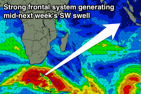
This is being generated by a flurry of vigorous polar frontal activity right under South Africa, with the best pulse for Wednesday and Thursday coming in at an infrequent 4-6ft across the Ments.
Variable winds are due to persist most of next week, keeping conditions clean.
Longer term there's nothing major on the cards with a gradual easing in size into the following weekend, but more on this Thursday.
16 day Mentawai forecast graph
16 day Nias forecast graph
16 day South Sumatra forecast graph