Indonesia/Maldives forecast Apr 10

Indian Ocean Basin analysis by Craig Brokensha (issued Thursday 10th April)
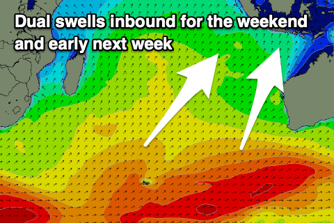
This week through next (Apr 11 - 18)
An inconsistent S/SW swell is in the water this morning and this will back off through tomorrow, further Saturday morning.
Now from the weekend we’ve got slowly building swell activity, strongest into Sunday afternoon and Monday, with a less consistent, long-range SW groundswell for Tuesday.
Firstly, Saturday afternoon and evening’s increase will be an extremely long-range and inconsistent SW groundswell, generated by a strong low that formed south-west of South Africa last week. It only looks to be moderate in size with very long waits between sets.

A better, more consistent S/SW swell is due into Sunday afternoon and Monday though, produced by a great, broad fetch of strong W/SW winds firing up between the Heard Island region and Western Australia the last couple of days.
The swell should peak in the moderate to large range from later Sunday but more so Monday morning, likely easing into the afternoon.
We then have one final pulse of strong, long-period SW groundswell for Tuesday, produced by the earlier stages of the frontal progression linked to Sunday/Monday’s energy. That being a great fetch of gale to severe-gale W’ly winds to the south-east of South Africa, resulting in another moderate to large pulse of energy, though very inconsistent.
The swell should start easing into the middle to end of the week, slowed by another long-range, inconsistent mid-period S/SW swell into later Thursday and Friday morning.
A relatively weak and distant low to the south-east of South Africa yesterday and this morning is the source of this swell with it only due to come in around the small to medium size range.
Longer term the Southern Ocean goes quiet with nothing of any major significance due the following week at this stage.
Local winds look variable offshore each morning ahead of moderate E/SE-SE trades over the coming days, shifting weak S’ly early next week and then W/SW-SW from Tuesday (into the afternoons) as a tropical cyclone forming in the Arafura Sea tracks west and then south of us.
In the Mentawais we’ve got variable winds and they look to remain fairly light while tending NW on the weekend, more variable into next week again.
----------------------------------------------
Maldives:
A fun pulse of inconsistent SE trade-swell energy should be in the water today, generated west of Western Australia late last week and into the weekend.
It’ll be inconsistent and hold tomorrow before easing through the weekend.
We then look at the S/SW groundswell pulses due across the southern atolls with no major changes to the expected timing or sizes since Tuesday thanks to them all being in the water already.
An initial, moderate sized pulse is due later today, peaking tomorrow, while a slightly stronger increase is due Sunday.
We should then see easing levels of swell into early next week, with the next increase being small and arriving next Thursday.
This was generated by the relatively weak low mentioned at the end of Indonesia’s notes, with SE trade-swell likely to muscle up through the middle to end of next week thanks to a broadening fetch of SE trades to our south-west from Friday but more so the weekend and into next week.
The swell should reach the moderate size range mid-late week but more on this Tuesday.
Eastern Indonesia:
Easing, inconsistent S’ly groundswell tomorrow.
Long-range, very inconsistent SW groundswell building Saturday afternoon, reaching 4-5ft+ late across exposed breaks.
More consistent mid-period S/SW swell building through Sunday, reaching 6ft to possibly 8ft through the day, holding Monday morning, easing later ahead of a stronger but less consistent groundswell Tuesday morning to 6ft to occasionally 8ft, easing Wednesday.
Small, inconsistent mid-period SW swell for later Thursday but more so Friday morning to 3-5ft across exposed breaks.
Moderate E/SE-SE trades this week (variable offshore each morning). Winds easing Monday and swinging back to the W/SW-SW from Tuesday (variable offshore each morning).
Uluwatu 16-day Forecast Graph/WAMs
Western Indonesia/Mentawais/South Sumatra:
Small-moderate sized mid-period SW swell tomorrow.
Long-range, very inconsistent SW groundswell building Saturday, reaching 4-6ft across exposed breaks into the afternoon.
Mod-large, inconsistent S/SW swell building Sunday, reaching 6ft+ into the afternoon, easing slowly Monday from a similar size.
Strong, less consistent long-period SW groundswell for later Monday but more so Tuesday morning to 6ft to occasionally 8ft, easing.
Small, inconsistent mid-period SW swell for Friday to 3-5ft across exposed breaks.
Variable winds, tending weak NW at periods through the weekend.
Mentawai 16-day Forecast Graph/WAMs
Maldives:
Inconsistent SE trade-swell today and tomorrow to 4ft across exposed breaks, easing into the weekend and next week.
Moderate + sized, inconsistent S/SW groundswell building later today, peaking tomorrow to 4-5ft across the southern atolls (smaller Male), easing Saturday.
Slightly better S/SW groundswell Sunday to 4-6ft across the southern atolls, easing slowly next week.
Moderate sized SE trade-swell building early next week, peaking from Wednesday through Friday.
Strong W/SW-SW winds today and tomorrow, easing slowly on the weekend and tending more W, then moderate W-W/NW into next week.
Comments
Latest notes are live.
Thank you Craig , not worried about the swell in a fortnight’s time but these persistent westerlies in the mentawai’s are a worry .
I hear ya man, im hitting Sumba 28 April for 12 days, and the ongoing westerlies are concerning. Hopefully a few more weeks and we start seeing south easterlies.
The Ment's best waves like West winds?
Euro and ozzie models less sanguine for trades than GFS model. If you're travelling might be worth checking. It's like a Trump stock market wind wise anything can happen. Either way I'm locked in to a trip to the big smoke will miss the lot