Indonesia/Maldives forecast January 25

Indian Ocean Basin analysis by Craig Brokensha (issued Thursday 24th January)
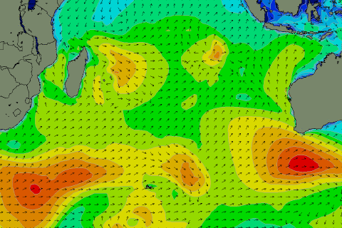
This week through next (Jan 25 - Feb 2)
We should be seeing some small mid-period S’ly swell building across the region today, mixed in with some poor W’ly windswell, with it due to start easing through tomorrow.
The surf will continue to bottom out into Saturday ahead of our new pulse of good S/SW groundswell late in the day but more so Sunday.
This groundswell has performed well in Western Australia today, with large surf across the Margaret River region (swell chart left) and waves on the metro beaches. The source was a healthy frontal system firing up to the south-west of Western Australia.
This should arrive on dark Saturday but peak Sunday to a strong 6ft across exposed breaks, with the rare bigger one on the magnets, easing into Monday from 4-5ft or so.
The current episode of W’ly winds are also due to ease back into the weekend with morning W/NW-NW winds, tending lighter W/SW-SW into the afternoons.
Stronger W’ly winds will then kick up again through mid-late next week.
Following this, some small, weak mid-period S/SW swell is due later in the week but to no real considerable size. More on this Tuesday.
Across in the Mentawais, some small, weak mid-period W/SW swell should be in the water this afternoon, peaking tomorrow and then easing into Saturday with variable SE winds.
The weekend looks better regarding the arrival of the S’ly groundswell with Sunday due to peak in the moderate size range, easing back through Monday. Following this the outlook is slow so make the most of Sunday’s swell.
The Maldives are still seeing a mix of E/NE windswell and background SE trade-swell, with the SE energy due to fade into the weekend.
Strengthening E/NE winds should kick up some building E/NE windswell on the weekend and early next week before winds ease again later in the week.
Other than that, our S’ly groundswell for later Monday and Tuesday is still on track. This has been generated by a strong but tight polar low that formed south-west and south of South Africa, projecting north-east into the Indian Ocean.
Following this, a cyclone sitting east of Madagascar named Candice is forecast to drop south and intensify over the coming days. This should generate some additional, small mid-period S’ly swell for Tuesday to Friday next week but below the size of the groundswell seen Tuesday.
Eastern Indonesia:
Small mid-period S’ly swell peaking this afternoon and Friday morning to 4ft across exposed breaks, easing into the weekend.
Moderate W/NW winds tomorrow, fresher W into the afternoon, weaker W/NW tending W/SW Saturday/Sunday.
Moderate + sized S/SW groundswell arriving late Saturday, peaking Sunday morning to 6ft across exposed breaks (possible rare bigger one), easing later and into next week.
Small, inconsistent mid-period S/SW swell for late next week.
Weak W/NW-NW tending W/SW winds Monday through Thursday next week, strengthening from next Friday.
Uluwatu 16-day Forecast Graph/WAMs
Western Indonesia/Mentawais/South Sumatra:
Small, inconsistent, mid-period W’ly swell arriving later today, peaking tomorrow, easing thereafter.
Moderate sized S’ly groundswell for Sunday to 4-5ft across exposed breaks, easing into next week.
Weak SE tending S/SE winds tomorrow, tending more variable Saturday/Sunday/Monday and then NW from Tuesday next week.
Mentawai 16-day Forecast Graph/WAMs
Maldives:
Weak E/NE windswell, building a touch into the weekend and more so early next week to 3ft+ along with strong E/NE winds, backing off mid-late next week. Moderate NE winds across southern locations.
Fading SE trade-swell over the coming days.
Moderate sized S’ly groundswell for later Monday, peaking Tuesday to 4-5ft across the southern atolls, slowing easing thereafter.
Comments
Latest notes are live.
Thanks Craig , the rain you said was coming later this month has arrived and it’s very welcome with water table getting very low . Some overhead sets today but not many , onshore was light before lunch. Hoping for that pulse on Sunday . There was a small earthquake last night, roughly 40 klms from here towards Lombok .
Good to hear all round Supa!
Bang on with your report thanks Craig , overhead sets today and fairly consistent 4-5 wave sets and a couple of bomb sets with 8 waves in them , glassy conditions up until about 11.30 am . Im hoping for it to glass off this arvo , if not tomorrow , although dropping should be another good day .
Awesome, yeah I heard it kicked nicely, stoked!