Large swell to end the week, lots of trade-swell for Micronesia and PNG

Hawaii North Shore forecast by Craig Brokensha (issued Tuesday 29th November)
Best Days: North Shore tomorrow and Wednesday, Friday through Sunday and mid-next week, PNG the whole period and Micronesia when the trade-swell gets bigger and the N'ly swell fills in
This week and next (Nov 30 – Dec 9)
Hawaii: A small lift in mid-period NW groundswell is due through today, peaking tomorrow to 3-4ft+ before easing off through Wednesday and bottoming out Thursday.
Friday's new NW groundswell is coming along well, with it currently being produced by a strong and deep low pressure system east of Japan.
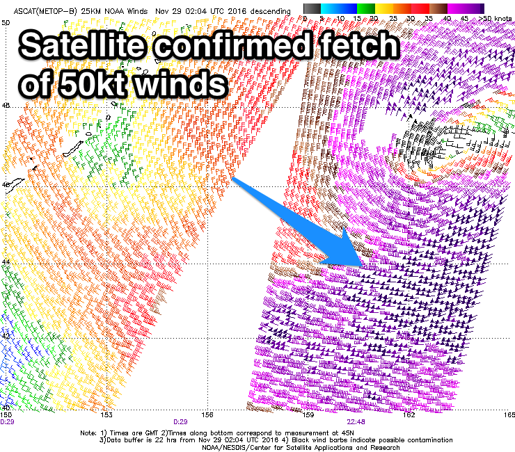 Satellite observations have already picked up a fetch of severe-gale to storm-force W/NW winds in our far swell window, and we'll see similar wind strengths maintained as the low continues east over the next 24 hours before weakening south of the Aleutians.
A strong, large and powerful NW groundswell is expected from this low, arriving on dark Thursday and peaking Friday around an inconsistent 8-10ft across the North Shore through the day, with the odd bigger cleanup set possible.
Fresh E'ly trades should create excellent conditions, easing off into Saturday as the swell also eases.
The easing trend should be softened through Sunday by a reinforcing mid-period NW swell, produced on the tail of the strong low before the surf becomes small into Monday and Tuesday.
Into the middle of next week another inconsistent NW groundswell is due from a more distant and weaker low stalling off Japan, coming in around the 6ft range.
Longer term there's nothing too notable on the cards, but more on this Thursday.
North Shore Forecast Graph
North Shore WAMs
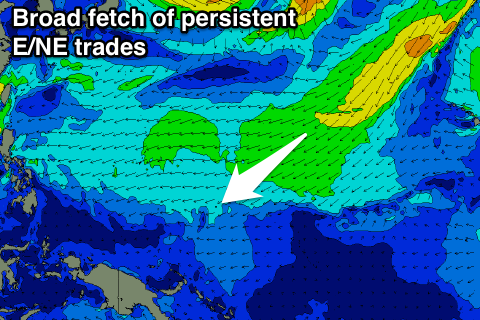
Micronesia: The current NE trade-swell across the region is expected to become larger through the coming period as a broad fetch of E/NE winds stretching out to our north-east intensifies through the end of the week, persisting into mid-next week.
 This should see exposed spots to the swell coming in around 3ft+ through tomorrow, building to 4ft+ Thursday before easing a touch into the end of the week.
The swell should kick up again through early next week with solid 5-6ft sets due, holding Tuesday before easing off later in the day.
The low off Japan should produce some inconsistent N'ly groundswell for the weekend, building Saturday to 3ft+ by dark and peaking Sunday morning around 3-4ft.
The secondary weaker low should produce another smaller pulse for Wednesday in the 3ft range.
With the strengthening trade-flow to our north-east we'll see fresh to strong E/NE trades through the whole period.
Palikir Pass Forecast Graph
Palikir Pass WAMs
Papua New Guinea: With the upgrade in the trade-swell across Micronesia, we'll see it filter down into PNG from Friday with good 3ft sets across exposed breaks. The swell should hold into early next week ahead of the stronger pulse Wednesday and Thursday, coming in at 3-4ft or so.
Variable winds should be seen over the coming period ahead of afternoon sea breezes.