Swell from the south and then north-east next week

Eastern Tasmania Surf Forecast by Craig Brokensha (issued Monday 3rd February)
Best Days: South swell magnets tomorrow, Wednesday morning, Thursday selected northern corners, Friday morning south swell magnets
Recap
Building N/NE swell Saturday with improving conditions for southern corners into the afternoon, great through the evening. Sunday was clean and easing from 2-3ft, while today there were reports of 2-3ft waves continuing out of a more easterly direction. The source is uncertain as the N/NE fetch moved away from us through the weekend.
This week and weekend (Feb 4 - 9)
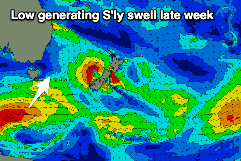
Into tomorrow we've got a mix of S'ly windswell and stronger S/SE groundswell on the cards, the first generated by a cold front sliding up past us today, and the second by a stationary fetch of strong to gale-force S/SE winds south of New Zealand from late last week through yesterday morning.
 The S/SE swell is due to fill in through the day and reach 3-4ft across exposed breaks into the afternoon, holding Wednesday and then easing Thursday.
Conditions will be clean tomorrow morning with a W/SW-SW offshore, ahead of NE sea breezes and then W/NW tending SE and then E/SE breezes Wednesday.
Into Thursday as the S/SE groundswell eases, a new S'ly groundswell will take its place, generated by a strong polar low moving through our swell window and then up towards New Zealand over the coming days.
The strength of this low has been upgraded since Monday and we should sets to 3-5ft across south swell magnets Thursday morning, easing through the day.
Unfortunately a surface trough starting to deepen on the East Coast will squeeze a strong high in the Tasman Sea, bringing onshore E/NE tending SE winds.
 Friday looks smaller with easing 2-3ft sets out of the south though with a light NW tending NE breeze.
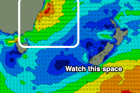
As we move into the weekend we're expected to see onshore winds and building levels of swell as the surface trough deepens further off the East Coast and drifts south. This will see a strengthening fetch of E/NE winds aimed through our north-eastern swell window from Friday through most of next week, with a secondary fetch of E/SE winds possibly developing from later next week.
Plenty of swell is due across our region from this source, but we'll have to look closer at the local winds and conditions (at this stage looking onshore and average) in the coming updates.