Fun end to the week, large back to back swells all next week

Java, Bali, Lombok, Sumbawa forecast by Craig Brokensha (issued Tuesday 12th July)
Best Days: Wednesday, Thursday, Friday, Sunday onwards experienced surfers
This week and next (Jul 13 - 22)
S'ly swell is currently impacting the islands, generated by a funky weather system off the West Australian coast over the weekend. This S'ly swell should hold a similar size most of the day before easing off into tomorrow from 6ft+ across south facing breaks (smaller along the Bukit Peninsula).
Later in the day and more so Thursday a new inconsistent long-range S/SW groundswell is due, generated last week by a vigorous polar front that fired up west of Heard Island before tracking east.
Very inconsistent but strong sets to 4-6ft are due Thursday morning across exposed breaks, easing back into the afternoon and further through Friday, bottoming out Saturday afternoon.
Winds are due to be variable each morning over the coming week, with weak E/SE trades into the afternoon.
 Now, moving into Sunday and more so next week, we'll enter a very active period of surf, probably the largest sustained run of swell and from the SW this season.
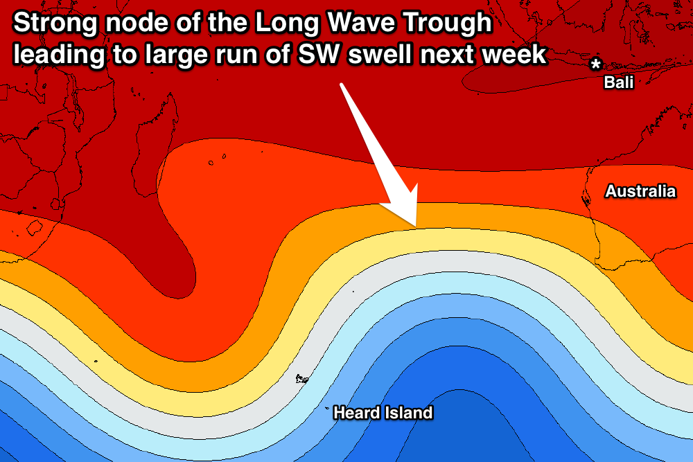
This will be related to a strong amplified node of the Long Wave Trough developing across the central to south-eastern Indian Ocean over the coming days.
With this we'll see back to back to back polar fronts directed one after the other up high into the Indian Ocean, generating large long-period pulses of SW groundswell.
The first frontal system is already developing north of Heard Island with a fetch of strengthening gale to severe-gale SW winds projecting towards the islands.
This should produce an initial large SW groundswell for the weekend, arriving overnight Saturday and building Sunday from the 5-6ft range at exposed breaks early to 8ft+ by dark.
Similar sized waves are due Monday morning, while a secondary pulse of larger SW groundswell is due on dark and more so into Tuesday morning, followed by a third into the afternoon and then fourth Wednesday.
These additional pulses will be generated by secondary stronger and broader polar fronts pushing up on the tail of the original system, on top of an already active sea state.
These additional pulses look to build more to the 8-10ft range through Tuesday, peaking to 8-10ft+ Wednesday morning across exposed breaks.
The SW direction will see more size getting into south-west facing breaks compared to the recent S'ly swells and moderate to fresh E/SE trades are expected to kick in (variable each morning) favouring these spots.
Easing surf is then due into Thursday, further into the weekend. More on this Thursday.
16 day Bali Forecast Graph
16 day East Java Forecast Graph
16 day Sumbawa Forecast Graph