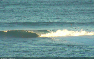
We’re just starting to see the early signs of fresh southerly swell activity, and this will translate to a slow building trend through Tuesday and Wednesday ahead of step-ladder increases into Thursday and Friday. More in the Forecaster Notes.
Primary tabs
/reports/forecaster-notes/sydney-hunter-illawarra/2019/08/19/large-south-windy-boot
thermalben
Monday, 19 August 2019
/reports/forecaster-notes/sydney-hunter-illawarra/2019/08/16/poor-weekend-ahead-dynamic-options-next
thermalben
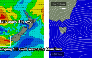
Friday, 16 August 2019
There’s a lot of dynamic weather on the cards for next week. More in the Forecaster Notes.
/reports/forecaster-notes/sydney-hunter-illawarra/2019/08/14/easing-southerly-swell-resuming-next
thermalben
Wednesday, 14 August 2019
Our recent southerly swell machine has only just vacated the swell window, so we’ll see persistent energy through today and tomorrow morning, before wave heights ease through Thursday afternoon and Friday. More in the Forecaster Notes.
/reports/forecaster-notes/sydney-hunter-illawarra/2019/08/12/plenty-south-swell-coming-days
thermalben
Monday, 12 August 2019
The conveyor belt of fronts responsible for our current energy are still quite active, and will remain so through Tuesday. This means we’ve got strong southerly swell through Thursday morning at least. More in the Forecaster Notes.
/reports/forecaster-notes/sydney-hunter-illawarra/2019/08/09/numerous-tricky-swell-sources-radar
thermalben
Friday, 9 August 2019
Synoptic charts don’t get much tricker for Southern NSW than they are now. More in the Forecaster Notes.
/reports/forecaster-notes/sydney-hunter-illawarra/2019/08/07/small-surf-few-days-then-strong-outta
thermalben
Wednesday, 7 August 2019
We’re now on the backside of our most recent southerly pulse, and we’re looking towards a temporary spell of smaller waves ahead of a renewal of strong south swell next week. More in the Forecaster Notes.
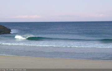
/reports/forecaster-notes/sydney-hunter-illawarra/2019/08/05/strong-southerly-swell-short-term-and
thermalben
Monday, 5 August 2019
Despite the swell charts showing much smaller surf for the next few days (it’s resolving the periods well, but not the swell size), I am holding steady with the forecast. More in the Forecaster Notes.
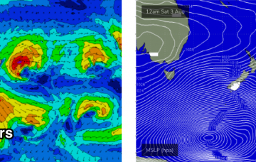
/reports/forecaster-notes/sydney-hunter-illawarra/2019/08/02/lots-strong-southerly-swell-ahead
thermalben
Friday, 2 August 2019
We’re still looking at a prolonged spell of elevated swells out of the south early next week - just a little smaller in size than previously suggested, though not by much. More in the Forecaster Notes.
/reports/forecaster-notes/sydney-hunter-illawarra/2019/07/31/long-spell-large-south-swell-and-light
thermalben
Wednesday, 31 July 2019
There’s plenty more south swell on the way. Of the large variety, too. More in the Forecaster Notes.
/reports/forecaster-notes/sydney-hunter-illawarra/2019/07/29/very-large-southerly-swells-way
thermalben
Monday, 29 July 2019
We’ve got a sustained run of southerly groundswell coming up for the next few weeks, and there are gonna be some big waves at times. More in the Forecaster Notes.