This enhanced trough/possible ECL setup will probably reach maximum strength later this weekend, and early next week will see a peak in surf size. More in the Forecaster Notes.
Primary tabs
/reports/forecaster-notes/south-east-queensland-northern-new-south-wales/2020/02/03/extended-run
thermalben
Monday, 3 February 2020
/reports/forecaster-notes/south-east-queensland-northern-new-south-wales/2020/01/31/keep-your-weekend
thermalben
Friday, 31 January 2020
The outlook for next week remains very dynamic, with some great waves on the way. More in the Forecaster Notes.
/reports/forecaster-notes/south-east-queensland-northern-new-south-wales/2020/01/29/next-weeks
thermalben
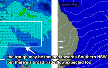
Wednesday, 29 January 2020
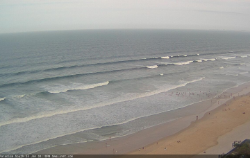
There’s always been a suggestion of a stationary trough somewhere along the East Coast, though it’s not been sure on where to place it (Southern NSW or Northern NSW). More in the Forecaster Notes.

/reports/forecaster-notes/south-east-queensland-northern-new-south-wales/2020/01/27/better-conditions
thermalben
Monday, 27 January 2020
Unfortunately, new swell sources are thin on the ground at the moment. But there are good options for the long term outlook. More in the Forecaster Notes.
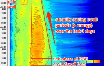
/reports/forecaster-notes/south-east-queensland-northern-new-south-wales/2020/01/24/hope-lies-just
thermalben
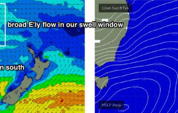
Friday, 24 January 2020
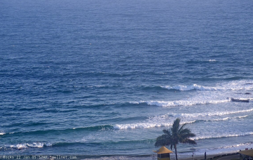
The arrival of today’s long range E’ly groundswell should be a cause for celebration, but unfortunately northerly winds will largely ruin surf conditions throughout the weekend. More in the Forecaster Notes.
/reports/forecaster-notes/south-east-queensland-northern-new-south-wales/2020/01/22/not-particularly
thermalben
Wednesday, 22 January 2020
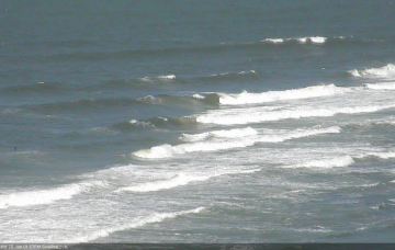
It’s hard to find enthusiasm when we’re looking at 48 hours of gusty N’ly winds across all coasts. But, there are pockets of opportunity for keen surfers. More in the Forecaster Notes.
/reports/forecaster-notes/south-east-queensland-northern-new-south-wales/2020/01/20/pesky-northerlies
thermalben
Monday, 20 January 2020
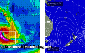
As discussed last week, we’ve got an extended period of northerlies ahead. More in the Forecaster Notes.
/reports/forecaster-notes/south-east-queensland-northern-new-south-wales/2020/01/17/prolonged-period
thermalben
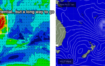
Friday, 17 January 2020
NE winds will remain entrenched across the coast, though there are a couple of possible exceptions to this scenario. More in the Forecaster Notes.
/reports/forecaster-notes/south-east-queensland-northern-new-south-wales/2020/01/15/significant
thermalben
Wednesday, 15 January 2020
Unfortunately the outlook for the weekend, and in fact much of next week has taken a turn for the worse. But not because of a lack of swell. More in the Forecaster Notes.
/reports/forecaster-notes/south-east-queensland-northern-new-south-wales/2020/01/13/plenty-swell
thermalben
Monday, 13 January 2020
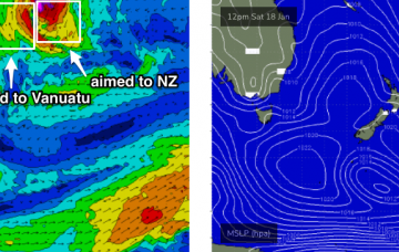
A large tropical cyclone is expected to develop north of Fiji over the coming days (it’s current tagged by JTWC as INVEST 93P) and the models have moved around on its future developments since Fridays notes were issued. More in the Forecaster Notes.