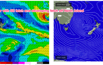
A strong zonal pattern with embedded fronts and troughs is under the continent and moving eastwards. That pattern is briefly interrupted by a trough and front today before resetting again over the weekend. No major swell sources on the radar so we’ll see if we can find anything flukey to work with.
Primary tabs
/reports/forecaster-notes/sydney-hunter-illawarra/2024/08/21/get-ready-grovel-period-small-flukey
freeride76
Wednesday, 21 August 2024
/reports/forecaster-notes/sydney-hunter-illawarra/2024/08/19/some-quality-the-s-week-quiet-spell
freeride76
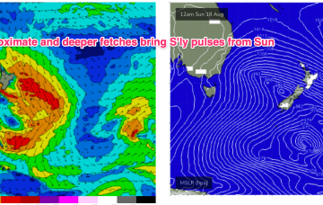
Monday, 19 August 2024
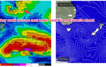
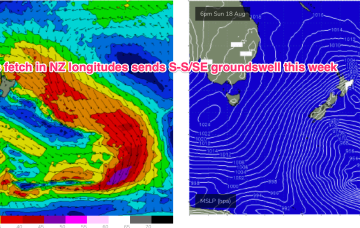
A deeper fetch now operating near New Zealand longitudes is better aimed at Pacific targets (some to Fiji, most to Tahiti) with some sideband S/SE groundswell due through the middle of this week.
/reports/forecaster-notes/sydney-hunter-illawarra/2024/08/16/freshening-wlies-few-pulses-in-s-swell
freeride76
Friday, 16 August 2024
Proximate winds will generate a pretty bog standard winter-style spike in short range S swell.
/reports/forecaster-notes/sydney-hunter-illawarra/2024/08/14/next-week-gets-upgrade-some-quality-s
freeride76
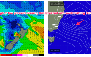
Wednesday, 14 August 2024
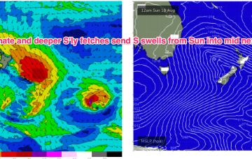
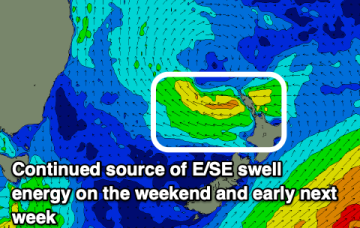
This pattern breaks down as we head into the weekend leaving a broad troughy area of low pressure in the Tasman which is expected to redevelop over the weekend and generate sizey S swells later in the weekend and early next week.
/reports/forecaster-notes/sydney-hunter-illawarra/2024/08/12/summer-style-swells-the-ene-week
freeride76
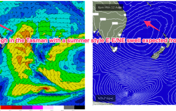
Monday, 12 August 2024
That trough is drawing down plenty of tropical moisture in the deep onshore flow, and generating sizey, stormy E’ly swells for the sub-tropics. Some of that swell energy will filter down to temperate NSW in reduced form but without all the bad weather, along with more local NE swells.
/reports/forecaster-notes/sydney-hunter-illawarra/2024/08/08/minor-swells-over-the-weekend-some
freeride76
Friday, 9 August 2024
No change expected to the broad pattern next week with strong high pressure moving into the Tasman and a broad, deep E’ly fetch developing through the Coral Sea, with an embedded trough. Most of the swell energy from this system will be aimed at sub-tropical targets.
/reports/forecaster-notes/sydney-hunter-illawarra/2024/08/07/power-down-enough-swell-energy-offer-few
freeride76
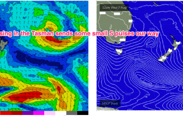
Wednesday, 7 August 2024
Over the weekend and next week the large high complex builds a broad E’ly fetch through the South Pacific and into the Coral Sea, generating sizey E swells for the sub-tropics with smaller E/NE swells filtering down to temperate NSW.
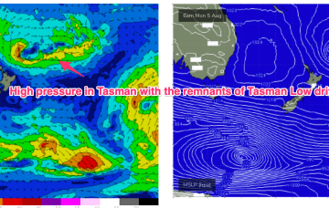
/reports/forecaster-notes/sydney-hunter-illawarra/2024/08/04/tasman-sea-takes-well-deserved-breather
freeride76
Monday, 5 August 2024
Pressure gradients will stay weak in our proximate and medium range spheres of influence so as the current E/SE swell ebbs away we’re in for a quiet spell on the surf front.
/reports/forecaster-notes/sydney-hunter-illawarra/2024/08/02/gradual-easing-in-size-the-swell-goes
Craig
Friday, 2 August 2024
The weekend looks great for surf with a more manageable sized swell and clean morning conditions.
/reports/forecaster-notes/sydney-hunter-illawarra/2024/07/31/big-surf-eases-and-becomes-more
freeride76
Wednesday, 31 July 2024
No change to the outlook as a massive, slow moving low pressure system in the Tasman and strong high over Tasmania combine to fill the Tasman Sea with gales to strong gales generating L to XL surf.