Tsunamis: In preparation for the big one

Travellers to Indonesia quickly become aware of its geology. It sits along the most active subduction zone in the world. The constant movement of the Australian plate beneath the Eurasian plate creates volcanos, earthquakes and tsunamis. The trench formed by the plate boundary parallels the coast from Aceh through to the Lesser Sunda Islands; exactly the same stretch of coast targeted by surfers in search of some of the planet's most perfect waves.
Travelling surfers are particularly vulnerable to tsunamis and there are many accounts of their experiences, from Bali in 1977 and G-Land in 1994, to the Boxing Day tsunami of 2004 and the Mentawais in 2010. Many increase the risk by staying at or close to sea level in areas where they may be unfamiliar with the local geography.
The vast majority of surfers are aware of the general danger but may be less aware of more immediate risks. In particular there is increasing concern from geologists about the risk of a magnitude 8 earthquake and accompanying tsunami in the Siberut region. Last month the Jakarta Post reported a series of intensifying earthquakes in the region that caused the Indonesian Geologists Association to express their concerns that a larger quake could be imminent.
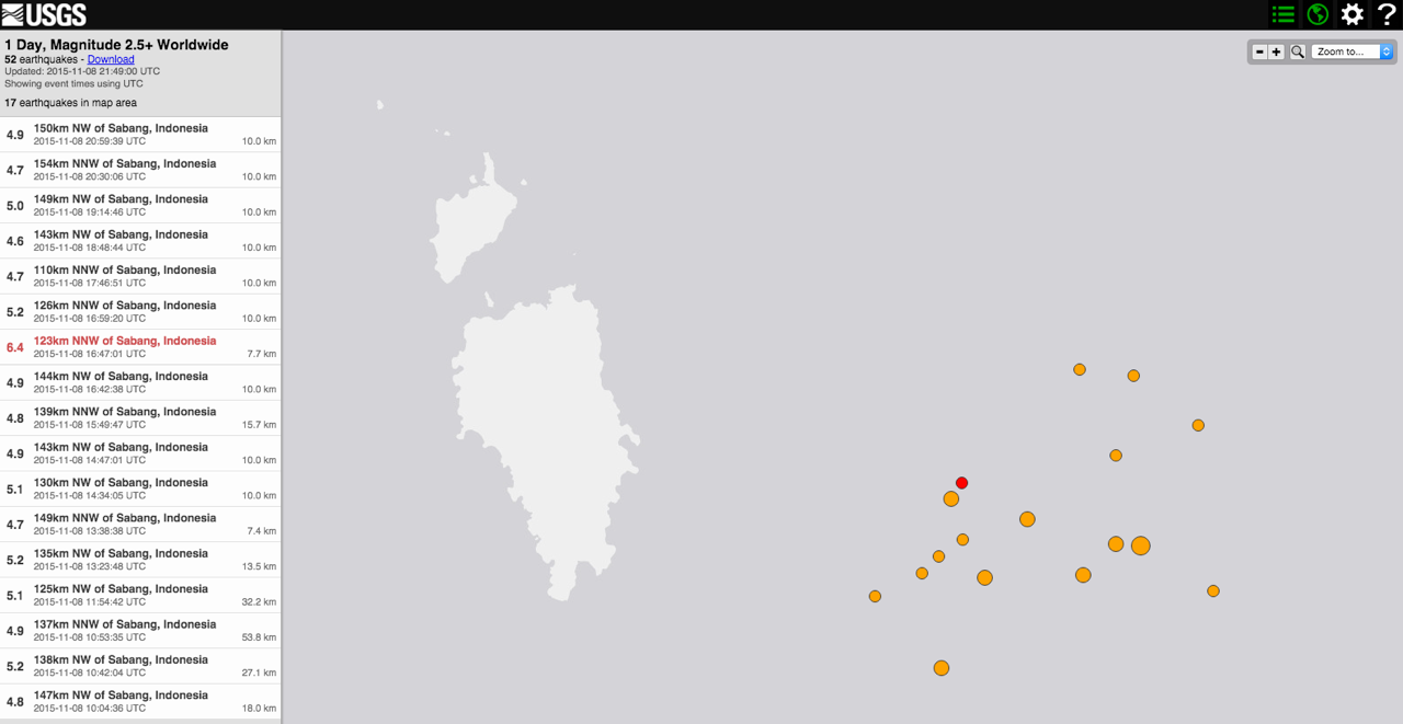
9th November, 2015: cluster of seventeen earthquakes within ten hours, just east of the Nicobar Islands. The biggest 6.4, the smallest 4.6. Almost two per hour!
Siberut is located close to the plate boundary at a point below the series of large earthquakes following the huge 2004 quake. Geologists predict that, as each quake occurs, the strain moves down the plate boundary, in this case to a point close to Siberut. Subduction zones produce the largest of all earthquakes and this region has historically experienced earthquakes greater than magnitude 8. So the present concerns are well justified.
Given that the earthquake would occur beneath the ocean a tsunami would be inevitable. The Earth Observatory of Singapore estimate that the tsunami would strike the Mentawai Islands within 5-10 minutes and would be of potentially devastating size. Two previous earthquakes in the region produced tsunamis of different sizes. The 2007 8.4 quake in the southern Mentawais produced a relatively small tsunami, while 2010 7.8 quake produced a large tsunami which killed over 500 people and completely washed away many villages.

NOAA's tsunami travel time map for the 2004 Indian Ocean tsunami
Last year the Indonesian Government ran a disaster relief exercise based on an 8.9 quake with a 10m tsunami but this focused on the Padang region. Surf Aid however have run a three year disaster preparedness program which finished in May 2014 and included the Sipora, Siberut and Nias areas.
While the greatest concern is for local populations the development of numerous surf camps in the area means that more surfers than ever before are at increased risk. If the lead time for a potential tsunami is 5 to 10 minutes it is absolutely essential that camps have a clear well organised plan. This would involve; well marked evacuation routes shown on arrival, mustering points above any likely run up zone, and the provisioning of some kind of shelters with non-perishables and first-aid essentials. In a major event it cannot be assumed assistance will arrive quickly.
The accuracy of any earthquake prediction is always in question. We simply do not know enough to be sure. So the predicted quake may come tomorrow, next week, next month, next year or in a decade. In this case though the recent history of quakes progressing down the fault is ominous. If you are planning a trip to the region it is well worth asking your travel agent, land camp or boat captain about their preparedness. Oh and make a donation to Surf Aid. If it doesn't save your life it will almost certainly save someone else's! //blindboy
You can donate to SurfAid here.
Comments
From my personal perspective after a very close shave in 2010, boats beat land camps for sure. However on a charter, make sure your skipper knows the safe anchorages in some decently deep water (eg not maccas bay, and never inside a lagoon!), and their crews are well schooled in tsunami drills - guests on the speedboat to deep water and boat close behind. Don't kid yourself that a big quake will feel substantial at sea - the 7.8 felt like a fine vibration, not scary at all, but could have been fatal. Minimise your time in Padang in transit - the place is a death trap if we get the big one.
Having said all that, I'm working on the lightning cant strike twice theory and going back every year because a potential 3 metre lift with the big one could screw all those perfect waves - adventure before dementia eh!
Good article and sage advice.
I was in Sumatra this year when we had two quakes within minutes of each other, a 6.2 and a 6.5 I think, only about 70ks off the coast. I was in the water at the time and didn't feel them at all. There was no tsunami warning issued, but it was still slightly unnerving. The area just south of Krui is quite flat country and there is nowhere close by to escape to. I did see a few taller hills but whether you could make it in time is the question. Its frightening to think of how many locals would be taken out if a big one happened. The guys over there reckon they are well over due for something big, but also reckon that the recent quakes are releasing some pressure under the plate so the big one may not eventuate? I wasn't so sure.
http://imgur.com/a/EkIW3
I'm hoping these come through. Local reef which I have never seen even on the lowest tides pre-tsunami and what it looks like breaking on a nice day. Pic was taken by a local old fella who lives above that spot. Only 5 minutes from my house. Amazing how much water was taken out to sea before it all came back in. Of course the destruction on that day is well documented.
I can't seem to upload the pics but here is the link. Hope it works.
My first trip to the Mentawai's was this year and I stayed on a land camp. Before I set foot on the transfer boat, the Tsunami evacuation signs around Padang Harbour reminded you that you are in an active seismic region. The resort itself was amazing, everything you imagine the ments to be and better! The Tsunami threat was clearly discussed at the briefing over lunch shortly after you arrive on the island. As the island is a coral cay there's not much relief therefore the resorts emergency strategy was to construct a ladder on selected coconut palms immediately adjacent to the beach so you could reach higher ground quickly. Lifejackets were provided and we were told to have valuables (passport etc) close by. Due to the isolation of the island we were informed of potential delays of receiving a tsunami warning and were advised that the local people had experienced strong fishy odours in the air prior to previous tsunami's as the water drained off the surrounding reefs. The threat felt very real after this briefing and everyone picked their tree just on the 'what if'. At the back of my mind I was thinking we'd have a few hours but the reality of a 5-10 minute window, as indicated in the article, is frightening especially if it happened in the middle of the night.
We all take risks everyday in life from the moment we leave the house and step into our cars. I scored epic waves and came home with a smile on my dial stoked to return to my family safe and sound.
During my stay there was some discussion about the expanding cheaper and 'illegal' surf camp scene in the mentawai's. If I was to return to stay at one of those I'd definitely be checking what strategy they have in place before parting with my dollars.
Why do you think there illegal?…Its been a while since I've stayed at Nyang Nyang/Ebay but last trip a few years ago even then the majority of those places had licences to operate a losmen/homestay, years before that things were different they never had licences to operate and use to tell us if the cops come just say you are staying for free.
I don't think you can make a call of which is safer boat or land, it could happen any time of the day or night, on a boat you could be totally unaware a quake has happened until its too late and all anchorages are different be it an overnight anchorage or anchored near a wave, not all are that deep and even if they seem very protected Tsunamis can come in at any angle and have nothing to do with normal swell direction, boats do have the advantage of having the CB Radio nearby though, so other boats would send out the word pretty fast.
On land you have a heaps better chance of being warned by nature as you will feel the quake and not likely sleep through it if at night, but some of those camps or resorts are just sitting ducks some are on low islands with no high spot to run and no elevated buildings, Macaronis resort ironically was probably one of the best and most prepared building in the Mentawai's, that thing had a huge steel centre post anchored into a massive concrete block, surrounded by full tree coconut post, and was a three story building about 10 metres plus high, fairly open downstairs to let water run through it and a circular shape to let water flow around it.
It scary to think what would happen if a tsunami hit the playgrounds/telescopes area most of those camps are low lying areas with little to no hills and single story buildings that would be swept away like a tent.
Not plugging any resorts here but those guys at Pitstop Hill are sitting the most pretty, they could sleep through the whole thing without even getting splashed.
I'll often think about this whilst camped on the tide line around the North West of Oz.
Same same.....but basically the same.
You're going to be fucked.
The boat verses land camp argument is irrelevant - there's too many variables.
The only safe bet is Pitstop Hill.
I was amongst the chaos of the 2009 gempa that flattened Padang, stayed for another 6 months to help, then lost friends in Gobik village (Sth Sipora) in 2010.
Carry an emergency bag, have a plan, donate to the good work of Surfaid, and perhaps recognise there's not much you can do in the face of such behemoth energy...
Fingers crossed but looks like they just dodged a bullet, with a 7.8 quake 800km out from Padang at 10km deep.
But normally when there is one there is more.
There was actually two last night, expect its probably a good thing expect would help relieve pressure on that plate and maybe help downgrade the predicted big one?
5.1 Southwest of Sumatra, Indonesia
2016-03-02 15:12:08 UTC16.4 km
7.8 Southwest of Sumatra, Indonesia
2016-03-02 12:49:48 UTC24.0 km
Another this morning, same spot but closer to the surface
5.5 Southwest of Sumatra, Indonesia
2016-03-03 00:10:50 UTC10.0 km
I'm not sure that this was the big one. Looks like the wrong spot. If that is the case it may have actually increased the risk! I will follow some of the geo sites over the next couple of weeks to see if they throw any light on it.
Yeah definitely not the big one, and yes possibly increased the risk of the big one happening sooner rather than latter with activity in the area, but i would have thought it would possibly help reduce how big the big one is?
People must be on edge there at the moment.
Again another well informed article BB.
I thought you had retired from writing!, the Cav Sav must of eased thee ol 'writer's cramp' a little;)
Brought up in NZ Wellington as a kid, we sure never got used to an Earthquake, that's for sure. A tremor or a good shake and you were taught to run and hide under a door head?
IMO after being an architectural draughtsman, this wasn't the most soundest place in a house??
But really the thought of running outside into the street and getting gobbled up by a huge crevasse was way more detrimental.
I always felt like a speck of dust, so miniscule, so vulnerable, they have such amazing power and it's scarey.
Like you have stated above, no-one really knows when the big one will happen.
Our knowledge is so minimal, in this timeline of our Earth.
Check the date on the piece welly. My retirement was a little premature and I have done a few things since. I am just playing by ear at the moment and tend to write when the load eases back at work. At the moment it is fairly intense. Getting in the water, music and family are all higher priorities but I still find time to enjoy the comments.
haha, missed the 'piece' and the date!
Funny as, at the moment there's many interesting pieces to read, I must admit.
Maybe the production as Ben stated, has gone viral.....
About time;)
USGS have put this up.
http://earthquake.usgs.gov/earthquakes/eventpage/us10004u1y#general_region
Main point, it was a strike slip event and so did not produce any significant tsunami. Hopefully more information about the risk of a megathrust quake will come out over the next couple of weeks
That area between Mentawai's and Padang seems a lot more active than normal in the last week or so lots of tremors in the 3 to 4 range.
This isn't good news either..
Indonesia’s Tsunami Sensors Were Down During Quake
Uummmm, Stealing for parts!
ID what do you think about that?
In Padang at the moment after being out in the mentawais,(going to telos tomorrow) was laying in bed this morning awake when the room started rocking I ran outside and it stopped, lots of motorbikes seemed to be heading for the hills, so I thought I better join them just incase as you never know what else is coming or until could get info on its size and location, after the initial burst of bikes zooming off not many people seemed to bother though, ended up being a 6.5 quake 50km away.
Nerve-wracking stuff ID.
Epicentre was a little closer to the Ments land camps, I imagine they would have been quite shaken up.
Not Mentawai's or Sumatra but decent size quake(6.2) just off Lakey Peak in Sumbawa.
I was in the Ments in Oct 09 staying at wavepark, we had a 7.6 and Padang was flattened and 2000 killed. I was on the island when it went down and it was the most frightening experience that I have encountered. My mate was in the water and said it felt like a small shudder in the water. No tsunami tho.
Nogo, I just left right before the earthquake hit, the hotel we were waiting in half collapsed. Super lucky but so sad.
The Great Wall of Japan ( Very sad alienating story for ocean lovers )
https://iview.abc.net.au/video/NC2110H005S00
Big problem. I was watching this last night and its mind-blowing the scale they are going to protect small towns, nothing of it makes sense. A while back I looked at google earth over Japan and so much of the coastline has been changed by humans forever, Does anyone know how many waves they have been losing. Also currently around the Great ocean road they have just built two new rock walls to stop the road from falling into the sea along the coastline right in front of the two best waves in the area depending on who you ask. At what point do us humans need to adapt to nature, rather than trying to adapt nature to us, because soon nothing natural will be left, and hopefully we don't end up ruining any waves in Victoria
Don't get me started.
I've been living in Japan for almost 15 years and in my time here, I've witnessed the loss of 12 surf spots due to sea walls. The fucked thing is that the beach is walled off and no access is provided so even if the waves are still there, you can't get to them.
To make it even worse, it's under the guise of 'erosion control' which btw is ironic because the sea walls and tetrapods are the cause of the erosion. Even sadder, it's just blatant pork barrelling- most of the construction companies are usually Yakuza backed fronts that had the coast divvied up years ago and paid bribes to the politicians to award the contracts and then the politicians retire and sit on the boards of these companies and the cycle continues. Everyone knows it but it's never talked about and I've heard that on that on more than one occasion anyone that does speak out may end up entombed in one of the walls..
Perfect example, up the road about 20 minutes, great little beachie, offshore in a southerly so pretty rare around these parts. Was a healthy beach, on the shore one of the last remaining stretches of coastal heath, behind that, nothing- no houses, no businesses just rice fields a couple of hundred metres inland. The fuckers bulldozed down the forest to get the heavy equipment in to build the wall to supposedly protect the coast. Now the forest is gone and the beach has eroded away so much that it washes up against the wall. Place is practically unsurfable now.
Fuckers!!! Hope they get cancer.
edit- here's the spot I'm talking about. You can see the scale of it.
pic sharing
And this is the wave we've lost for ever.
Super super heavy eh! Seeing it with Zen first hand myself it's quite sad and shocking :(