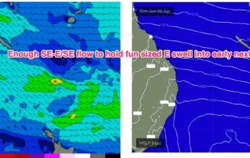
Small E/SE swell holds early next week- generated by winds in the Coral Sea and the slot between New Caledonia and the North Island and offering up fun, rideable waves on low tides.
Primary tabs
/reports/forecaster-notes/central-queensland/2024/04/26/tiny-and-surfable-over-the-weekend-rideable
freeride76
Friday, 26 April 2024
/reports/forecaster-notes/central-queensland/2024/04/24/small-just-rideable-coming-back-next-week
freeride76
Wednesday, 24 April 2024
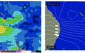
A monster high (1037hPa) moves into the Bight tomorrow and slowly weakens as it enters the Tasman on the weekend, bringing SE winds into the Coral Sea and holding a small signal of SE-E/SE swell that will hold just rideable surf.
/reports/forecaster-notes/central-queensland/2024/04/22/plenty-surf-easing-slowly-tomorrow
freeride76
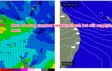
Monday, 22 April 2024
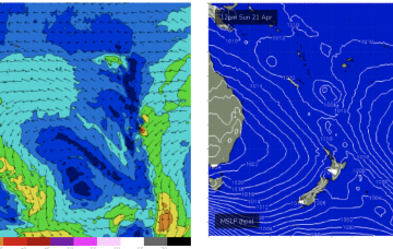
Smaller surf than indicated on Fri due to the structure, strength and positioning of the Coral Sea low.
/reports/forecaster-notes/central-queensland/2024/04/19/pumping-surf-developing-over-the-weekend
freeride76
Friday, 19 April 2024
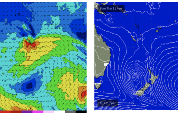
By Mon morning we should have a complex trough of low pressure NE of K’gari (Fraser Is) with a well developed fetch of strong SE winds feeding into the low and extending well out into the Coral Sea.
/reports/forecaster-notes/central-queensland/2024/04/17/small-fun-waves-continue-juicier-prospects
freeride76
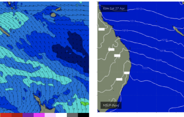
Wednesday, 17 April 2024
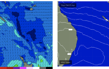
The gist of it is a trough line in the Coral Sea, which may deepen into a low pressure system and drift towards the North Island (GFS scenario) or move towards the QLD coast as a coastal trough and intensify a NE infeed into the CQ coast, possibly as early as Sun bringing a major increase in E-E/NE swell.
/reports/forecaster-notes/central-queensland/2024/04/10/tiny-just-surfable-waves-next-week
freeride76
Wednesday, 10 April 2024
Some signs of a rebuild in SE-E/SE winds in the Coral Sea next week should add to the mix and hold rideable surf from Tues-Fri.
/reports/forecaster-notes/central-queensland/2024/04/08/small-boost-then-back-tiny-just-surfable
freeride76
Monday, 8 April 2024
A high E of NZ is feeding winds into a trough in the Coral Sea and that will hold fun surf today and into tomorrow.
/reports/forecaster-notes/central-queensland/2024/04/05/fun-surf-over-the-weekend-easing-next-week
freeride76
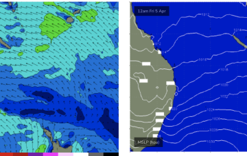
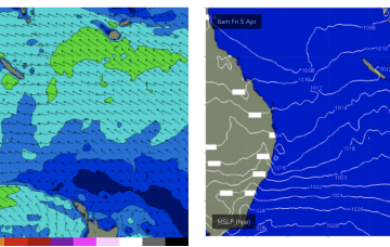
Friday, 5 April 2024
We’ve got large peanut shaped high centred over Tasmania with lobes in the Bight and Tasman Sea. The moist onshore flow from this set-up is flowing into a coastal trough and small trough of low pressure off the NQLD coast bringing fun sized E swell.
/reports/forecaster-notes/central-queensland/2024/04/01/just-surfable-week-nice-boost-possible-the
freeride76
Monday, 1 April 2024
Weak but persistent tradewinds in the Coral Sea should hold surf just rideable on low tides. If the retrograding low comes off as modelled we’ll see a nice boost in size from Fri into the weekend.
/reports/forecaster-notes/central-queensland/2024/03/29/fun-surf-continues-easter-easing-back-later
freeride76
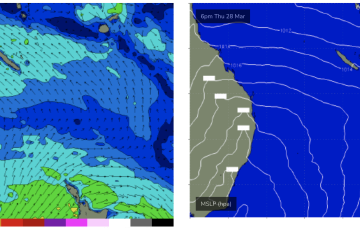
Friday, 29 March 2024
High pressure in the Tasman is maintaining a ridge along the QLD coast with fun sized surf across the CQ region under mod/fresh SE winds.