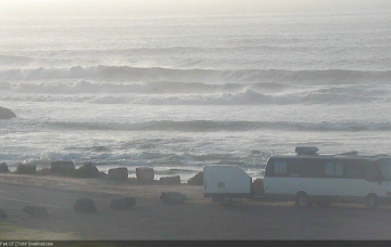
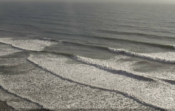
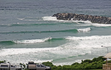
Today’s S’ly groundswell will reach a peak in size overnight and - based on trend observations across Victoria and Southern NSW - will likely ease steadily through Tuesday morning. But, there's more swell on the way! More in the Forecaster Notes.
Primary tabs
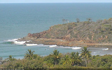
/reports/forecaster-notes/south-east-queensland-northern-new-south-wales/2020/03/02/few-windows-good
thermalben
Monday, 2 March 2020
/reports/forecaster-notes/south-east-queensland-northern-new-south-wales/2020/02/28/patchy-short-term
thermalben
Friday, 28 February 2020
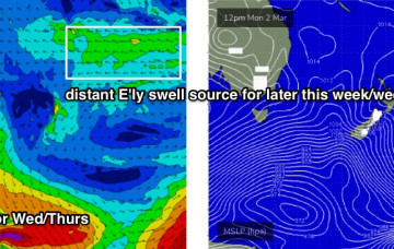
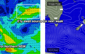
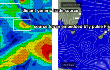
Next week will see a continual background source of E’ly swell from a stationary fetch in the South Pacific, atop a large high pressure system, slowly building towards a next weekend. Prior to then we'll see a bunch of S'ly groundswells for Northern NSW. More in the Forecaster Notes.
/reports/forecaster-notes/south-east-queensland-northern-new-south-wales/2020/02/26/residual-andor
thermalben
Wednesday, 26 February 2020
The weekend outlook has changed a lot since Monday. But the long term is very promising. More in the Forecaster Notes.
/reports/forecaster-notes/south-east-queensland-northern-new-south-wales/2020/02/24/wide-range-swell
thermalben
Monday, 24 February 2020
A more dominant swell will provide decent waves for south facing beaches south of Byron both Tuesday and Wednesday. Next week looks very interesting too! More in the Forecaster Notes.
/reports/forecaster-notes/south-east-queensland-northern-new-south-wales/2020/02/21/steady-round-the
thermalben
Friday, 21 February 2020
There’ll be waves most days, just don’t expect anything amazing. Long term has a few interesting options too. More in the Forecaster Notes.
/reports/forecaster-notes/south-east-queensland-northern-new-south-wales/2020/02/19/back-recurring
thermalben
Wednesday, 19 February 2020
Today’s northerlies will be a distant memory by Thursday morning. And there's more swell on the way too. More in the Forecaster Notes.
/reports/forecaster-notes/south-east-queensland-northern-new-south-wales/2020/02/17/inbound-energy
thermalben
Monday, 17 February 2020
So, ex-TC Uesi exited our swell window early in the weekend. But, amazingly, it’s still generating new swell and we’ve got some more groundswell on the way. More in the Forecaster Notes.
/reports/forecaster-notes/south-east-queensland-northern-new-south-wales/2020/02/14/steadily-easing
thermalben
Friday, 14 February 2020
Let’s be frank: the last few weeks of forecaster notes have been lengthy reads, thanks to complex synoptic patterns. Fortunately, this weekend's outlook is relatively straightforward. More in the Forecaster Notes.
/reports/forecaster-notes/south-east-queensland-northern-new-south-wales/2020/02/12/strong-cyclone
thermalben
Wednesday, 12 February 2020
On the balance, there are no major changes to the Forecaster Notes for this upcoming cyclone swell event. There are a few small points of discussion worth tabling though.
/reports/forecaster-notes/south-east-queensland-northern-new-south-wales/2020/02/10/large-cyclone
thermalben
Monday, 10 February 2020
TC Uesi will properly enter our swell window on Tuesday morning, and right now it’s looking like it will push south-west towards Northern NSW through the middle to latter part of the week. More in the Forecaster Notes.
