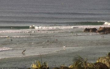
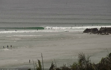
Going on the swell trend in Southern NSW today - which managed 6ft sets in Sydney and 8ft bombs in Newcastle - there won’t be any shortage of south swell tomorrow. Though, the trend will be steadily down. More in the Forecaster Notes.
Primary tabs
/reports/forecaster-notes/south-east-queensland-northern-new-south-wales/2020/05/04/more-the-south
thermalben
Monday, 4 May 2020
/reports/forecaster-notes/south-east-queensland-northern-new-south-wales/2020/05/01/action-plenty
thermalben
Friday, 1 May 2020
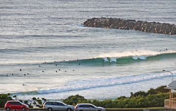
Sunday is a dynamic day for surf. More in the Forecaster Notes.
/reports/forecaster-notes/south-east-queensland-northern-new-south-wales/2020/04/29/plenty-the-east
thermalben
Wednesday, 29 April 2020
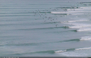
Nice to see both swell windows active. More in the Forecaster Notes.
/reports/forecaster-notes/south-east-queensland-northern-new-south-wales/2020/04/27/theres-quite-few
thermalben
Monday, 27 April 2020
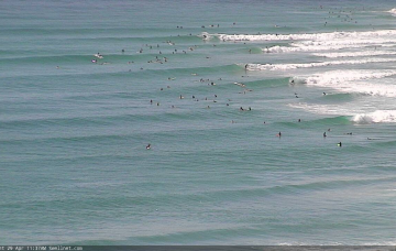
We’ve got some fun E’ly swell on the way. But you’ll have to work around the winds. More in the Forecaster Notes.
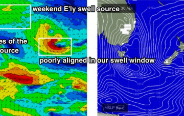
/reports/forecaster-notes/south-east-queensland-northern-new-south-wales/2020/04/24/not-much-weekend
thermalben
Friday, 24 April 2020
The ridge through the Coral Sea will broaden across the Northern Tasman Sea and out into the South Pacific next week. More in the Forecaster Notes.

/reports/forecaster-notes/south-east-queensland-northern-new-south-wales/2020/04/22/quietly-quietly
thermalben
Wednesday, 22 April 2020
The trades will slowly freshen through next week, and extend from the Coral Sea back out into the south-western Pacific Ocean. More in the Forecaster Notes.

/reports/forecaster-notes/south-east-queensland-northern-new-south-wales/2020/04/20/quietening-down
thermalben
Monday, 20 April 2020
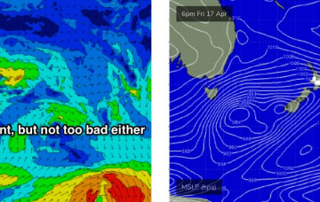
We’re generally looking at a spell of very small surf across the region. Our east swell window is devoid of activity, however there are a couple of flukey south swells that’ll glance the coast. More in the Forecaster Notes.
/reports/forecaster-notes/south-east-queensland-northern-new-south-wales/2020/04/17/turning-the
thermalben
Friday, 17 April 2020
We’ve got a steady supply of building southerly swells on the cards, originating from two seperate fetches contained within one broader system, all associated with an amplifying Long Wave Trough. More in the Forecaster Notes.
/reports/forecaster-notes/south-east-queensland-northern-new-south-wales/2020/04/15/more-swells-out
thermalben
Wednesday, 15 April 2020
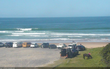
Sometime mid-late afternoon, I’m expecting the regional wave buoys (in Northern NSW) to have picked up the leading edge (15+ seconds) of a new SE swell generated by an intense low that formed S/SE of New Zealand on Monday - in actual fact, a merger between the low that generated our current swell, and a new polar low. More in the Forecaster Notes.
/reports/forecaster-notes/south-east-queensland-northern-new-south-wales/2020/04/13/southerly-swells
thermalben
Monday, 13 April 2020
Strong fronts have been pushing through the lower Tasman Sea all weekend, and they’ll provide plenty of south swell for the next few days. More in the Forecaster Notes.