Easterly Swell Feast
Tuesday 30/07 16
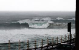
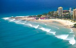
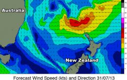
Following a sporadic start to winter, the whole East Coast is on target for a pumping east swell beginning this Friday as a broad belt of trade-winds develop above New Zealand.
Following a sporadic start to winter, the whole East Coast is on target for a pumping east swell beginning this Friday as a broad belt of trade-winds develop above New Zealand.
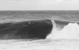
The most interesting, and also the best, characteristic regarding low pressure systems that form close to the coast are the wide range of winds available in a very short stretch of coastline. The following lesson is something to keep in mind the next time a similar sytem strikes.
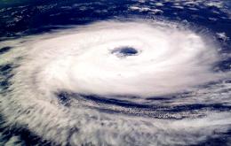
When the LWT stalls and amplifies east of New Zealand, Southern Ocean storms are supercharged and steered deep into the South Pacific on a course towards Tahiti.
With this in mind we'll probably see the competition run over the coming 4 days before going back into a holding pattern.
Early indications are very promising and there's even a good chance for a solid swell over the Easter break.
You've only got one more shot at getting stuck into some elusive cyclone swell before summer comes to a close. And if predictions ring true, it'll all be contained within the coming three weeks.
Here at Swellnet, we are strong believers in the following train of thought: the most classic of East Coast swells come not from isolated Tropical Cyclones but the combination of a cyclone with a strong supporting high pressure ridge.
On the back of a relatively poor cyclone season earlier in the year, it's welcoming to see the first signs of tropical activity forming in the Fiji region.


But there is good news ahead. The much discussed Long Wave Trough (info here) is about to enter a strengthening phase in the Southern Ocean, and we're looking at two to three weeks of heavy swell activity for the southern states.
The Sydney buoy rose 9 metres in one hour