Mix of E/SE and SW swells for the coming days
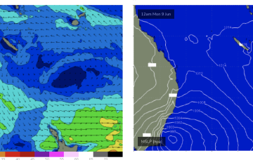
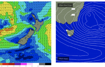
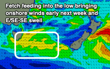
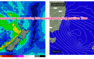
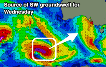
Winds will slowly improve over the coming days along with moderate levels of E/SE swell and some background SW groundswell.
The South Coast looks nice and offshore from Wednesday, with a strong westerly groundswell and a window of good winds due across the Mid Coast later week.
While conditions improve from tomorrow, Wednesday onwards looks much better with the arrival of back to back, moderate sized groundswells.
Have fun over the next few days off pumping surf as there is a lot of uncertainty into next week
There’s a S’ly flow currently weakening and no swell producing winds behind it.
We’ll then see a few days of elevated surf with strong winds to low end gales in the southern flank of the low aimed up at Tasmania.
Some new swell for Sunday will be met with dicey winds, onshore and stormy early next week.
The story of next week is still a stalled low in the Tasman- although swell potential gets a major upgrade as the low gets moving Tues and gets into a swell generating position.
The story of next week is still a stalled low in the Tasman- although swell potential gets a major upgrade as the low gets moving Tues into a swell producing position.
We've got another cold, stormy weekend of surf, with better windows next week.